
IMAGES TAKEN NEAR TO
Llys Ffyddion, RHYL, LL18 6BZ
Introduction
This page details the photographs taken nearby to Llys Ffyddion, LL18 6BZ by members of the Geograph project.
The Geograph project started in 2005 with the aim of publishing, organising and preserving representative images for every square kilometre of Great Britain, Ireland and the Isle of Man.

There are currently over 7.5m images from over14,400 individuals and you can help contribute to the project by visiting https://www.geograph.org.uk
Image Map
Images are licensed for reuse under creativecommons.org/licenses/by-sa/2.0
Notes
- Clicking on the map will re-center to the selected point.
- The higher the marker number, the further away the image location is from the centre of the postcode.
Image Listing (37 Images Found)
Images are licensed for reuse under creativecommons.org/licenses/by-sa/2.0
Image
Details
Distance
1

Voel Coaches at Dyserth
Bus and coach operator based in Dyserth.
Image: © Richard Hoare
Taken: 26 May 2014
0.09 miles
2

Pick your colour of bus or coach
Multi-coloured coach company operating in the U.K. and on the continent.
Image: © Richard Hoare
Taken: 26 May 2014
0.13 miles
3

Voel, Voel, Voel and Voel
Bank holiday Monday at the coach depot.
Image: © Richard Hoare
Taken: 26 May 2014
0.13 miles
4
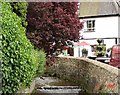
Tearooms at Dyserth waterfalls
The tearooms and river at Dyserth waterfalls
Image: © Dot Potter
Taken: 22 Jul 2005
0.14 miles
5
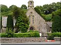
Dyserth Church
The village church at Dyserth
Image: © Dot Potter
Taken: 22 Jul 2005
0.14 miles
6
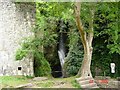
Dyserth Waterfalls
The waterfalls at the centre of the village of Dyserth
Image: © Dot Potter
Taken: 22 Jul 2005
0.14 miles
7
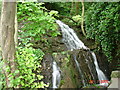
Dyserth Waterfalls
One of the side falls at Dyserth waterfalls
Image: © Dot Potter
Taken: 22 Jul 2005
0.14 miles
8
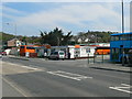
Voel Coaches depot
Founded in 1949, Voel Coaches is one of North Wales’ longest established family businesses providing British and European coach holidays, day excursions and group holidays.
Image: © Eirian Evans
Taken: 2 May 2012
0.15 miles
9
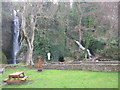
Dyserth Waterfalls
The photograph shows both sections of the fall with the most photographed section to the left.
The River Ffyddion rises 4½ miles to the east of here. After falling 70 feet over this waterfall, the river flows westwards and joins the River Clwyd west of Rhuddlan.
Image: © G Laird
Taken: 18 Mar 2015
0.17 miles
10
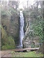
Dyserth Waterfall
This is the most photographed section of the falls. For a wider view, see Image
The River Ffyddion rises 4½ miles to the east of here. After falling 70 feet over this waterfall, the river flows westwards and joins the River Clwyd west of Rhuddlan.
Image: © G Laird
Taken: 18 Mar 2015
0.17 miles