
IMAGES TAKEN NEAR TO
Bryniau, RHYL, LL18 6BY
Introduction
This page details the photographs taken nearby to Bryniau, LL18 6BY by members of the Geograph project.
The Geograph project started in 2005 with the aim of publishing, organising and preserving representative images for every square kilometre of Great Britain, Ireland and the Isle of Man.

There are currently over 7.5m images from over14,400 individuals and you can help contribute to the project by visiting https://www.geograph.org.uk
Image Map
Images are licensed for reuse under creativecommons.org/licenses/by-sa/2.0
Notes
- Clicking on the map will re-center to the selected point.
- The higher the marker number, the further away the image location is from the centre of the postcode.
Image Listing (22 Images Found)
Images are licensed for reuse under creativecommons.org/licenses/by-sa/2.0
Image
Details
Distance
1
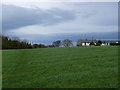
Llwybr Clawdd Offa / Offa's Dyke Path
Golygfa dros caeau ar Lwybr Clawdd Offa / A view over fields on the Offa's Dyke Path.
Image: © Ian Medcalf
Taken: 6 Apr 2010
0.01 miles
2
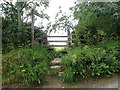
Offa's Dyke Path signpost
Heading for Marian Cwm
Image: © Eirian Evans
Taken: 22 Jul 2020
0.05 miles
3
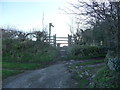
Stile on Offa's Dyke Path near Bryniau
A familiar stile with beckoning views rolling on to one big adventure.
Image: © Jeremy Bolwell
Taken: 2 Jan 2012
0.05 miles
4
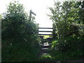
A steep stile on Offa's Dyke Path
This stile necessitates walkers climbing up rough stone steps in the bank and negotiating hawthorn, thistle, nettles and brambles to gain the field on the other side. It is one of many awkward stiles on the 177 mile path and even laden with a huge rucksack you become adept at assessing their individual foibles, utilising just the necessary energy (and no more) and crossing them efficiently, then forgetting them.
Image: © Jeremy Bolwell
Taken: 27 Aug 2010
0.08 miles
5
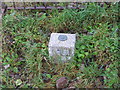
Ordnance Survey Fundamental Bench Mark
This can be found beside the road at Bryniau. The benchmark height is recorded as being 128.9 metres above sea level.
For more detail see : https://www.bench-marks.org.uk/bm1054
Image: © Peter Wood
Taken: 24 Nov 2018
0.08 miles
6
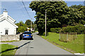
Lane in Bryniau
Castle House is on the left. There is a fundamental bench mark behind the railings to the right of the photograph and a closer view can be seen here: Image
Image: © Mark Anderson
Taken: 7 Aug 2023
0.09 miles
7
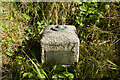
Fundamental Bench Mark, Bryniau
Bench Mark Database: https://www.bench-marks.org.uk/bm1054
Image: © Mark Anderson
Taken: 7 Aug 2023
0.09 miles
8
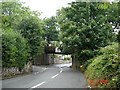
Disused railway line at Meliden
Disused railway bridge at Meliden
Image: © Dot Potter
Taken: 28 Jul 2005
0.10 miles
9
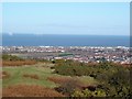
Graig Fawr View
From the upper slopes of Graif Fawr, looking over the town of Prestatyn with the windfarms clearly visible out to sea
Image: © Dot Potter
Taken: 14 Jan 2006
0.10 miles
10
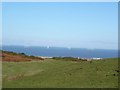
Graig Fawr to the windfarms
A view of the windfarms taken from Graig Fawr which is in the foreground
Image: © Dot Potter
Taken: 14 Jan 2006
0.10 miles