
IMAGES TAKEN NEAR TO
Hiraddug Park, RHYL, LL18 6AH
Introduction
This page details the photographs taken nearby to Hiraddug Park, LL18 6AH by members of the Geograph project.
The Geograph project started in 2005 with the aim of publishing, organising and preserving representative images for every square kilometre of Great Britain, Ireland and the Isle of Man.

There are currently over 7.5m images from over14,400 individuals and you can help contribute to the project by visiting https://www.geograph.org.uk
Image Map
Images are licensed for reuse under creativecommons.org/licenses/by-sa/2.0
Notes
- Clicking on the map will re-center to the selected point.
- The higher the marker number, the further away the image location is from the centre of the postcode.
Image Listing (56 Images Found)
Images are licensed for reuse under creativecommons.org/licenses/by-sa/2.0
Image
Details
Distance
1
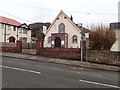
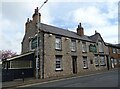
Capel Dyserth Chapel
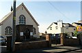
Dyserth Chapel is home to Horeb United Reformed Church – the only English speaking, nonconformist church in the village of Dyserth.
Image: © Eirian Evans
Taken: 12 Feb 2019
0.03 miles
7
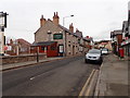
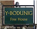
Y Bodunig
Public house on the High Street in Dyserth
Image: © Eirian Evans
Taken: 12 Feb 2019
0.06 miles
8

Elizabeth II postbox on High Street, Dyserth
Postbox No. LL18 99.
Outside the Post Office.
See Image] for context.
Image: © JThomas
Taken: 17 Apr 2024
0.06 miles
9
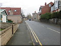
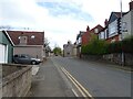
High Street (A5151) in Dyserth
Looking north-eastward.
Image: © Peter Wood
Taken: 24 Nov 2018
0.06 miles
10
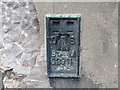
Ordnance Survey Flush Bracket G2911
This bracket can be found on the roadside wall of a building in High Street, Dyserth. The benchmark height is recorded as being 78.723 metres above sea level.
For more detail see : https://www.bench-marks.org.uk/bm830
Image: © Peter Wood
Taken: 24 Nov 2018
0.08 miles