
IMAGES TAKEN NEAR TO
Woodside Avenue, RHYL, LL18 5NE
Introduction
This page details the photographs taken nearby to Woodside Avenue, LL18 5NE by members of the Geograph project.
The Geograph project started in 2005 with the aim of publishing, organising and preserving representative images for every square kilometre of Great Britain, Ireland and the Isle of Man.

There are currently over 7.5m images from over14,400 individuals and you can help contribute to the project by visiting https://www.geograph.org.uk
Image Map
Images are licensed for reuse under creativecommons.org/licenses/by-sa/2.0
Notes
- Clicking on the map will re-center to the selected point.
- The higher the marker number, the further away the image location is from the centre of the postcode.
Image Listing (34 Images Found)
Images are licensed for reuse under creativecommons.org/licenses/by-sa/2.0
Image
Details
Distance
1
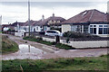
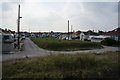
Glascoed Avenue, Kinmel Bay
The bungalows here are of a type that can only really be found in coastal areas - cheaply built and not very substantial, they were probably only ever intended to be holiday homes. With the unadopted road clearly in poor condition the overall impression is not especially appealing, although the bungalows themselves appear to be well looked after.
Image: © Stephen McKay
Taken: 8 Oct 2021
0.04 miles
4
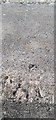
Ordnance Survey Rivet
This OS rivet can be found on the sea wall. It marks a point 6.968m above mean sea level.
Image: © Adrian Dust
Taken: 13 Sep 2019
0.07 miles
6
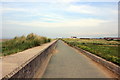
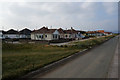
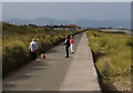
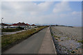
The North Wales Path at Kinmel Bay
The North Wales Path heading east at Kinmel Bay. The Wales Coast Path also runs along the same route.
Image: © Jeff Buck
Taken: 27 May 2014
0.08 miles
7
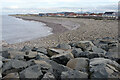
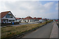
Kinmel Bay Beach
The shingle beach stretches away towards the River Clwyd and Rhyl backed by bungalows.
Image: © Stephen McKay
Taken: 8 Oct 2021
0.10 miles
10
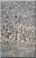
Ordnance Survey Rivet
This OS rivet can be found on the sea wall. It marks a point 6.974m above mean sea level.
Image: © Adrian Dust
Taken: 13 Sep 2019
0.14 miles