IMAGES TAKEN NEAR TO
Russell Road, RHYL, LL18 3DG
Introduction
This page details the photographs taken nearby to Russell Road, LL18 3DG by members of the Geograph project.
The Geograph project started in 2005 with the aim of publishing, organising and preserving representative images for every square kilometre of Great Britain, Ireland and the Isle of Man.

There are currently over 7.5m images from over14,400 individuals and you can help contribute to the project by visiting https://www.geograph.org.uk
Image Map
Images are licensed for reuse under creativecommons.org/licenses/by-sa/2.0
Notes
- Clicking on the map will re-center to the selected point.
- The higher the marker number, the further away the image location is from the centre of the postcode.
Image Listing (107 Images Found)
Images are licensed for reuse under creativecommons.org/licenses/by-sa/2.0
Image
Details
Distance
1
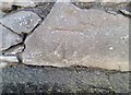
Ordnance Survey Cut Mark
This OS cut mark can be found on the wall SE side of Russell Road. It marks a point 7.608m above mean sea level.
Image: © Adrian Dust
Taken: 13 Sep 2019
0.01 miles
2

Preswylfa Care Home, Rhyl
Nursing, residential and respite care provided here.
Image: © Eirian Evans
Taken: 2 May 2012
0.06 miles
3
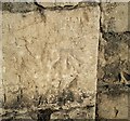
Ordnance Survey Cut Mark
This OS cut mark can be found on the wall between Nos79 & 81 Russell Road. It marks a point 7.480m above mean sea level.
Image: © Adrian Dust
Taken: 13 Sep 2019
0.08 miles
4
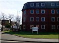
Russell House, Rhyl
Denbighshire council offices on Churton Road.
Image: © Eirian Evans
Taken: 2 May 2012
0.09 miles
5
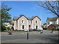
Rhianfa Veterinary Centre
Veterinary service for small animals and horses.
Image: © Eirian Evans
Taken: 2 May 2012
0.12 miles
6
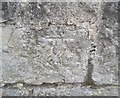
Ordnance Survey Cut Mark
This OS cut mark can be found on the wall between Nos10 & 12 St Asaph Street. It marks a point 8.975m above mean sea level.
Image: © Adrian Dust
Taken: 13 Sep 2019
0.12 miles
7
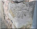
Ordnance Survey Cut Mark
This OS cut mark can be found at the junction of East Parade & Tarleton Street. It marks a point 8.550m above mean sea level.
Image: © Adrian Dust
Taken: 13 Sep 2019
0.12 miles
8
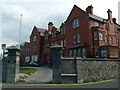
St David's Residential Home, Rhyl
Formerly known as Colet House, this used to be a prep school. It is on the junction of East Parade and Tarleton Street.
Image: © Eirian Evans
Taken: 14 Sep 2007
0.12 miles
9
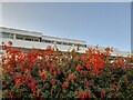
A Glimpse of Glendower Court
Attractive modernist architecture on Rhyl seafront. I have long admired the style of this building.
Image: © David Bremner
Taken: 20 Jul 2021
0.12 miles