IMAGES TAKEN NEAR TO
Ernest Street, RHYL, LL18 2DW
Introduction
This page details the photographs taken nearby to Ernest Street, LL18 2DW by members of the Geograph project.
The Geograph project started in 2005 with the aim of publishing, organising and preserving representative images for every square kilometre of Great Britain, Ireland and the Isle of Man.

There are currently over 7.5m images from over14,400 individuals and you can help contribute to the project by visiting https://www.geograph.org.uk
Image Map
Images are licensed for reuse under creativecommons.org/licenses/by-sa/2.0
Notes
- Clicking on the map will re-center to the selected point.
- The higher the marker number, the further away the image location is from the centre of the postcode.
Image Listing (69 Images Found)
Images are licensed for reuse under creativecommons.org/licenses/by-sa/2.0
Image
Details
Distance
1
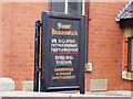
Signboard outside Soar Brunswick Chapel
Image: © David and Rachel Landin
Taken: 16 Jun 2007
0.05 miles
2
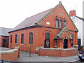
Soar Brunswick Welsh Methodist Chapel
Image: © David and Rachel Landin
Taken: 16 Jun 2007
0.06 miles
3
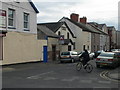
Sisson Street, Rhyl
An Apostolic Church is tucked away here.
Image: © Eirian Evans
Taken: 6 Mar 2012
0.09 miles
4

St Vincent's
Charity Shop on Vale Road in aid of the St Vincent de Paul Society http://svp.org.uk/
Image: © Gerald England
Taken: 14 Sep 2015
0.12 miles
5
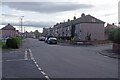
Kingsley Avenue, Rhyl
Local authority built housing in the suburbs of Rhyl.
Image: © Stephen McKay
Taken: 8 Oct 2021
0.13 miles
6
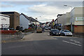
Vale Road, Rhyl
After coming down from the Vale Road Bridge over the railway, the A525 heads south east away from the town centre. The Little Theatre, built on the site of a former primary school in 1963, can be seen on the left; it was the first purpose built theatre for children in the UK.
Image: © Stephen McKay
Taken: 8 Oct 2021
0.13 miles
7
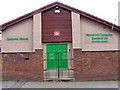
Computer company , previously Kingdom Hall of Jehovah's Witnesses
This building, down a side street in Rhyl, was once the Kingdom Hall of Jehovah's Witnesses. They have moved to new premises in Prestatyn and the building is now occupied by a computer repair company.
Image: © David and Rachel Landin
Taken: 16 Jun 2007
0.14 miles
8
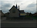
St Ann's Church, Rhyl
Situated on Vale Road.
Image: © Eirian Evans
Taken: 6 Mar 2012
0.14 miles
9
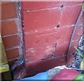
Ordnance Survey Cut Mark
This OS cut mark can be found on No58 Marsh Road. It marks a point 4.714m above mean sea level.
Image: © Adrian Dust
Taken: 13 Sep 2019
0.16 miles