
IMAGES TAKEN NEAR TO
Gwynfryn Avenue, RHYL, LL18 2BH
Introduction
This page details the photographs taken nearby to Gwynfryn Avenue, LL18 2BH by members of the Geograph project.
The Geograph project started in 2005 with the aim of publishing, organising and preserving representative images for every square kilometre of Great Britain, Ireland and the Isle of Man.

There are currently over 7.5m images from over14,400 individuals and you can help contribute to the project by visiting https://www.geograph.org.uk
Image Map
Images are licensed for reuse under creativecommons.org/licenses/by-sa/2.0
Notes
- Clicking on the map will re-center to the selected point.
- The higher the marker number, the further away the image location is from the centre of the postcode.
Image Listing (22 Images Found)
Images are licensed for reuse under creativecommons.org/licenses/by-sa/2.0
Image
Details
Distance
1
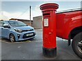
Postbox at Rhyl
LL18 161. Royal Mail list this box as 'Marsh Road'.
Image: © David Bremner
Taken: 6 Nov 2022
0.21 miles
2

Girls dancing teams at competition
Held on a coach park on a Saturday afternoon
Image: © David and Rachel Landin
Taken: 30 Jul 2005
0.21 miles
3

Cambrian Auto Parts
Car breakers company
Image: © David and Rachel Landin
Taken: 30 Jul 2005
0.21 miles
4
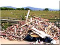
Outside Rhyl Tip on reclaimed marsh land
Image: © David and Rachel Landin
Taken: 30 Jun 2005
0.21 miles

7
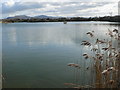
Brickfields Pond, Rhyl
Looking across Brickfields Pond, with the Clwydian Mountains in the background.
Image: © Eirian Evans
Taken: 27 Feb 2008
0.22 miles
8

Ordnance Survey Cut Mark
This OS cut mark can be found on No73 Marsh Road. It marks a point 4.751m above mean sea level.
Image: © Adrian Dust
Taken: 13 Sep 2019
0.22 miles
9
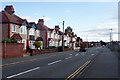
Ffordd Las, Rhyl
1930s style semi-detached houses line the eastern side of Ffordd Las leading away from its junction with Marsh Road.
Image: © Stephen McKay
Taken: 8 Oct 2021
0.23 miles
10
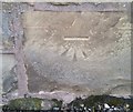
Ordnance Survey Cut Mark
This OS cut mark can be found on the wall SE side of the road. It marks a point 10.016m above mean sea level.
Image: © Adrian Dust
Taken: 13 Sep 2019
0.23 miles