
IMAGES TAKEN NEAR TO
Bedford Street, RHYL, LL18 1SY
Introduction
This page details the photographs taken nearby to Bedford Street, LL18 1SY by members of the Geograph project.
The Geograph project started in 2005 with the aim of publishing, organising and preserving representative images for every square kilometre of Great Britain, Ireland and the Isle of Man.

There are currently over 7.5m images from over14,400 individuals and you can help contribute to the project by visiting https://www.geograph.org.uk
Image Map
Images are licensed for reuse under creativecommons.org/licenses/by-sa/2.0
Notes
- Clicking on the map will re-center to the selected point.
- The higher the marker number, the further away the image location is from the centre of the postcode.
Image Listing (244 Images Found)
Images are licensed for reuse under creativecommons.org/licenses/by-sa/2.0
Image
Details
Distance
1
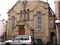
Islamic Cultural Centre (previously Welsh Baptist Church)
This building used to be the Welsh Baptist Church in Rhyl (to be distinguished of course from the English Baptist Church which meets in another Church building).
It has now been taken over as the Islamic Cultural Centre.
Image: © David and Rachel Landin
Taken: 16 Jun 2007
0.02 miles
2
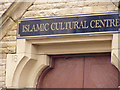
Entrance sign over Islamic Cultural Centre in Rhyl
This building was previously the Welsh Baptist chapel.
Image: © David and Rachel Landin
Taken: 16 Jun 2007
0.02 miles
3
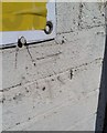
Ordnance Survey Cut Mark
This OS cut mark can be found on the Indoor Market, Wellington Road. It marks a point 20.63ft above mean sea level.
Image: © Adrian Dust
Taken: 13 Sep 2019
0.04 miles
4
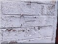
O.S Benchmark
Recorded on Benchmark Database as 'Rhyl, Indoor Market'.
Image: © David Bremner
Taken: 28 Mar 2024
0.04 miles
5
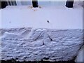
O.S Pivot Benchmark
Recorded on Benchmark Database as 'Rhyl, #15 Crescent Road'.
Image: © David Bremner
Taken: 28 Mar 2024
0.05 miles
6
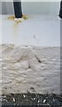
Ordnance Survey Pivot
This OS pivot can be found on the wall of No15 Crescent Road. It marks a point 6.600m above mean sea level.
Image: © Adrian Dust
Taken: 13 Sep 2019
0.05 miles
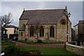
8
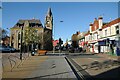
Wellington Street
Wellington Street and Rhyl Town Hall. Rhyl town hall was built in 1874-6, to designs of Wood and Turner of Barrow. The clock tower has a distinct lean.
Image: © Philip Halling
Taken: 26 May 2021
0.06 miles
10
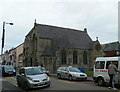
Christ Church, Rhyl
Opened in 1858 as an English congregation, the church on Water Street deteriorated so much within 30 years that it was declared unsafe and was demolished. A new building was erected on the same site in 1885. It is now a member of the United Reformed Church.
Image: © Eirian Evans
Taken: 11 Jan 2008
0.06 miles