IMAGES TAKEN NEAR TO
Sandfield Place, RHYL, LL18 1DY

Introduction

This page details the photographs taken nearby to Sandfield Place, LL18 1DY by members of the Geograph project.

The Geograph project started in 2005 with the aim of publishing, organising and preserving representative images for every square kilometre of Great Britain, Ireland and the Isle of Man.

There are currently over 7.5m images from over14,400 individuals and you can help contribute to the project by visiting https://www.geograph.org.uk

Image Map


Images are licensed for reuse under creativecommons.org/licenses/by-sa/2.0
Notes
  • Clicking on the map will re-center to the selected point.
  • The higher the marker number, the further away the image location is from the centre of the postcode.

Image Listing (126 Images Found)

Images are licensed for reuse under creativecommons.org/licenses/by-sa/2.0
  • ...
Image
Details
Distance
1
Wood Road, Rhyl
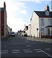
From Ellis Avenue across Warren Road towards Wood Road which leads to Westbourne Avenue.
Image: © Jaggery Taken: 1 Nov 2017
0.01 miles
2
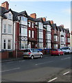
Alternating 2-storey and 3-storey buildings, Seabank Road, Rhyl
Image: © Jaggery Taken: 1 Nov 2017
0.02 miles
3
Wood Road, Rhyl
Viewed across Westbourne Avenue.
Image: © Jaggery Taken: 1 Nov 2017
0.03 miles
4
Seabank Road, Rhyl
Viewed across Warren Road. Ahead for Marine Lake and the miniature railway.
Image: © Jaggery Taken: 1 Nov 2017
0.04 miles
5
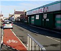
G E Tools Ltd store, Wood Road, Rhyl
Viewed in November 2017. A June 2009 Google Earth Street View shows the Power Tool Centre here.
Image: © Jaggery Taken: 1 Nov 2017
0.04 miles
6
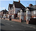
Three-storey houses, Seabank Road, Rhyl
Viewed from the corner of Westbourne Avenue.
Image: © Jaggery Taken: 1 Nov 2017
0.04 miles
7
Peter Pan Nursery, Rhyl
Children's day nursery at 2 Seabank Road on the corner of Victoria Avenue.
Image: © Jaggery Taken: 1 Nov 2017
0.05 miles
8
Aldi, Rhyl
Supermarket set back from the south side of Wellington Road.
Image: © Jaggery Taken: 1 Nov 2017
0.05 miles
9
Three-storey houses, Warren Road, Rhyl
Between Seabank Road and Wood Road.
Image: © Jaggery Taken: 1 Nov 2017
0.05 miles
10
Rhyl Bowling Club pavilion
Viewed across Seabank Road. The name sign on the pavilion shows that Bowling Club is Clwb Bowlio in Welsh.
Image: © Jaggery Taken: 1 Nov 2017
0.06 miles
  • ...