
IMAGES TAKEN NEAR TO
Buckley Avenue, RHYL, LL18 1DW
Introduction
This page details the photographs taken nearby to Buckley Avenue, LL18 1DW by members of the Geograph project.
The Geograph project started in 2005 with the aim of publishing, organising and preserving representative images for every square kilometre of Great Britain, Ireland and the Isle of Man.

There are currently over 7.5m images from over14,400 individuals and you can help contribute to the project by visiting https://www.geograph.org.uk
Image Map
Images are licensed for reuse under creativecommons.org/licenses/by-sa/2.0
Notes
- Clicking on the map will re-center to the selected point.
- The higher the marker number, the further away the image location is from the centre of the postcode.
Image Listing (116 Images Found)
Images are licensed for reuse under creativecommons.org/licenses/by-sa/2.0
Image
Details
Distance
1
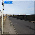
Cycle Route 84 direction sign, Rhyl
The sign points towards this https://www.geograph.org.uk/photo/5939123 bridge over the North Wales Coast Line railway. At the October 2018 date of the upload of this photo taken in November 2017, the Sustrans website states that Route 84 of the National Cycle Network will connect Rhyl to Oswestry via the Vale of Clwyd and the Llangollen Canal. Most of the route is still under development.
Image: © Jaggery
Taken: 1 Nov 2017
0.04 miles
2
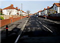
Ellis Avenue, Rhyl
From the corner of Warren Road along Ellis Avenue towards Barry Road and Garnett Avenue.
Image: © Jaggery
Taken: 1 Nov 2017
0.06 miles
3
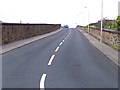
The H Bridge in Rhyl
A railway bridge built in an H shape with four approach roads (parallel to the railway tracks) and one crossing span.
Image: © David and Rachel Landin
Taken: 30 Jul 2005
0.06 miles
4
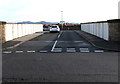
Road bridge over the North Wales Coast Line railway, Rhyl
Viewed from the unnamed road between Ffynnongroew Road and Warren Road. Ahead for Marsh Road.
Image: © Jaggery
Taken: 1 Nov 2017
0.06 miles
5
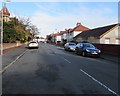
Seabank Road, Rhyl
From the corner of Westbourne Avenue along Seabank Road towards Warren Road.
Image: © Jaggery
Taken: 1 Nov 2017
0.07 miles
6
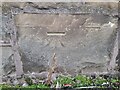
OS Benchmark
Recorded on Benchmark Database as 'Rhyl, Marsh Road'.
Image: © David Bremner
Taken: 6 Nov 2022
0.07 miles
7
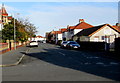
Seabank Road, Rhyl
From Westbourne Avenue along Seabank Road towards Warren Road.
Image: © Jaggery
Taken: 1 Nov 2017
0.07 miles
8
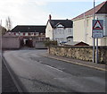
Warning sign - Humps for 530 yards, Rhyl
On the approach to the southeast corner of Warren Road. The text is also in Welsh.
Image: © Jaggery
Taken: 1 Nov 2017
0.07 miles
9
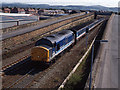
Trains at Rhyl - 1993 (5)
Diesel locomotive 37429 approaches Rhyl station with the 16.00 passenger service from Holyhead to Stafford.
Image: © The Carlisle Kid
Taken: 23 Jun 1993
0.07 miles
10
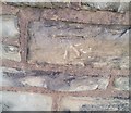
Ordnance Survey Cut Mark
This OS cut mark can be found on the wall NW side of the road. It marks a point 8.071m above mean sea level.
Image: © Adrian Dust
Taken: 13 Sep 2019
0.07 miles