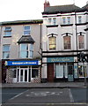
IMAGES TAKEN NEAR TO
Bodfor Street, RHYL, LL18 1AT

Introduction

This page details the photographs taken nearby to Bodfor Street, LL18 1AT by members of the Geograph project.

The Geograph project started in 2005 with the aim of publishing, organising and preserving representative images for every square kilometre of Great Britain, Ireland and the Isle of Man.

There are currently over 7.5m images from over14,400 individuals and you can help contribute to the project by visiting https://www.geograph.org.uk

Image Map


Images are licensed for reuse under creativecommons.org/licenses/by-sa/2.0
Notes
  • Clicking on the map will re-center to the selected point.
  • The higher the marker number, the further away the image location is from the centre of the postcode.

Image Listing (208 Images Found)

Images are licensed for reuse under creativecommons.org/licenses/by-sa/2.0
  • ...
Image
Details
Distance
1
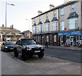
Costigans pub Rhyl
On reflection the street signs are significant to the text. 'One Way' (upwards) and 'No entry'. Costigan’s was in existence before the railway arrived here in 1848. Rhyl Life April 2009 reveals that the pub was the home of Mr James Costigan, an Irishman who secured a licence to sell alcohol. Eventually it became ‘Railway Refreshment Rooms’ where Rhyl's first Catholic Masses were held before the town had its own Catholic church. In 1951 the building became ‘The Mermaid’ pub. Later on, after reverting to the name Costigan’s, it was a home of Rhyl Folk Club for a while before becoming derelict.
Image: © Richard Hoare Taken: 21 Jun 2010
0.01 miles
2
Rhyl Bus Station
Viewed across Bodfor Street. Rhyl railway station https://www.geograph.org.uk/photo/5905469 is on the right.
Image: © Jaggery Taken: 1 Nov 2017
0.02 miles
3
Station News, Bodfor Street, Rhyl
Lifestyle Express convenience store & off licence. Rhyl railway station is in the background.
Image: © Jaggery Taken: 1 Nov 2017
0.02 miles
4
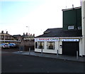
Bridge Cafe, Rhyl
The Rhyl bus station side of Bridge Cafe at 8 Kinmel Street.
Image: © Jaggery Taken: 1 Nov 2017
0.02 miles
5
Imperial Hotel, Rhyl
The Kinmel Street side of the Imperial Hotel at 34 Bodfor Street. The hotel's children's room is on the right.
Image: © Jaggery Taken: 1 Nov 2017
0.02 miles
6
Rhyl Bus Station
Rhyl's bus station is located immediately outside the railway station. In this view an Arriva bus is awaiting departure for Denbigh.
Image: © Stephen McKay Taken: 8 Oct 2021
0.02 miles
7
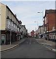
Bodfor Street, Rhyl
Looking past Bee & Station Business Centre https://www.geograph.org.uk/photo/5905450 on the left.
Image: © Jaggery Taken: 1 Nov 2017
0.02 miles
8
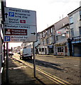
A548 directions sign, Kinmel Street, Rhyl
Image: © Jaggery Taken: 1 Nov 2017
0.02 miles
9
K?isha's Kabin, Bodfor Street, Rhyl
Eat in or take away cafe near the corner of Kinmel Street.
Image: © Jaggery Taken: 1 Nov 2017
0.02 miles
10
Seaworld Aquatics, 9 Kinmel Street, Rhyl
Text on the nameboard includes TROPICAL - MARINES - COLDWATER - PONDFISH - KOI
Image: © Jaggery Taken: 1 Nov 2017
0.02 miles
  • ...