IMAGES TAKEN NEAR TO
The Roe, ST. ASAPH, LL17 0HY
Introduction
This page details the photographs taken nearby to The Roe, LL17 0HY by members of the Geograph project.
The Geograph project started in 2005 with the aim of publishing, organising and preserving representative images for every square kilometre of Great Britain, Ireland and the Isle of Man.

There are currently over 7.5m images from over14,400 individuals and you can help contribute to the project by visiting https://www.geograph.org.uk
Image Map
Images are licensed for reuse under creativecommons.org/licenses/by-sa/2.0
Notes
- Clicking on the map will re-center to the selected point.
- The higher the marker number, the further away the image location is from the centre of the postcode.
Image Listing (8 Images Found)
Images are licensed for reuse under creativecommons.org/licenses/by-sa/2.0
Image
Details
Distance
1
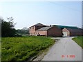
Gwernigron Farm
View of Gwernigron Farm which is centred within the square. Consisting of several farm buildings, grain stores and cottages.
Image: © Dot Potter
Taken: 24 Apr 2005
0.21 miles
2
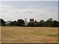
Dovecote and Farm at St. Asaph
Farm buildings including a stone dovecote.
This dovecote supposedly marks the site where a treaty was signed between Dafydd ap Llewellyn and Henry III after the battle of Rhuddlan Marsh in 1287.
Image: © Dot Potter
Taken: 23 Jul 2005
0.21 miles
3

Turnips to Cathedral
Looking over the turnip fields to St. Asaph Cathedral in the distance
Image: © Dot Potter
Taken: 25 Dec 2005
0.21 miles

5

March snow at the farm
Farmyard in the snow
Image: © Dot Potter
Taken: 4 Mar 2006
0.21 miles
6

Farm gardens
After a light covering of snow during the previous night the gardens on the farm take on a wintry feel
Image: © Dot Potter
Taken: 12 Mar 2006
0.21 miles
7

Snowy lane
Light snowfall the previous evening left the lane to the farm with a covering of snow and ice
Image: © Dot Potter
Taken: 12 Mar 2006
0.21 miles