
IMAGES TAKEN NEAR TO
Lower Denbigh Road, ST. ASAPH, LL17 0EL
Introduction
This page details the photographs taken nearby to Lower Denbigh Road, LL17 0EL by members of the Geograph project.
The Geograph project started in 2005 with the aim of publishing, organising and preserving representative images for every square kilometre of Great Britain, Ireland and the Isle of Man.

There are currently over 7.5m images from over14,400 individuals and you can help contribute to the project by visiting https://www.geograph.org.uk
Image Map
Images are licensed for reuse under creativecommons.org/licenses/by-sa/2.0
Notes
- Clicking on the map will re-center to the selected point.
- The higher the marker number, the further away the image location is from the centre of the postcode.
Image Listing (10 Images Found)
Images are licensed for reuse under creativecommons.org/licenses/by-sa/2.0
Image
Details
Distance
1
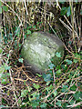
Milestone by the B5381, Lower Denbigh Road, St Asaph
This milestone is on the west side of the B5381, south of St Asaph and fairly well hidden in the hedge. There's no inscription visible so it may be buried or the stone may be broken. For a wider view see Image
Inscription once read:
(Rhuddlan 3)
(Denbigh 5)
Image: © John S Turner
Taken: 24 Sep 2022
0.06 miles
2
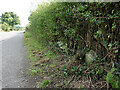
The B5381, Lower Denbigh Road and a milestone
The milestone is on the west side of the B5381, south of St Asaph.
See also: Image
Image: © John S Turner
Taken: 24 Sep 2022
0.06 miles
3
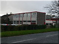
Honeywell Offices, St Asaph
Environmental and Combustion Controls offices in St Asaph
Image: © Eirian Evans
Taken: 9 Nov 2007
0.12 miles
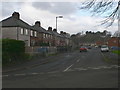
5
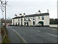
New Inn, St Asaph
On Lower Denbigh Road, St Asaph
Image: © Eirian Evans
Taken: 9 Nov 2007
0.14 miles
6
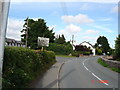
Llanelwy
Llanelwy (St.Asaph) approached from the west
Image: © Dot Potter
Taken: 7 Jul 2005
0.14 miles
7
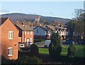
Llanelwy o'r de orllewin / St Asaph from the south west
Image: © Ceri Thomas
Taken: 26 Nov 2009
0.16 miles
8
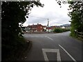
North Wales Pilgrims Way
The North Wales Pilgrims Way makes use of this minor road from St Asaph.
Image: © David Bremner
Taken: 9 Jun 2024
0.21 miles
9
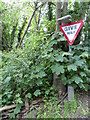
Give Way
At the junction of a minor road with the B5381.
Image: © David Bremner
Taken: 9 Jun 2024
0.21 miles
10
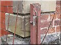
Ordnance Survey Cut Mark
This OS cut mark can be found on the SW angle of the chapel on Lower Denbigh Road. It marks a point 16.182m above mean sea level.
Image: © Adrian Dust
Taken: 28 Mar 2023
0.24 miles