IMAGES TAKEN NEAR TO
Cae Drain Road, DENBIGH, LL16 5AD
Introduction
This page details the photographs taken nearby to Cae Drain Road, LL16 5AD by members of the Geograph project.
The Geograph project started in 2005 with the aim of publishing, organising and preserving representative images for every square kilometre of Great Britain, Ireland and the Isle of Man.

There are currently over 7.5m images from over14,400 individuals and you can help contribute to the project by visiting https://www.geograph.org.uk
Image Map
Images are licensed for reuse under creativecommons.org/licenses/by-sa/2.0
Notes
- Clicking on the map will re-center to the selected point.
- The higher the marker number, the further away the image location is from the centre of the postcode.
Image Listing (5 Images Found)
Images are licensed for reuse under creativecommons.org/licenses/by-sa/2.0
Image
Details
Distance
1
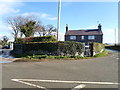
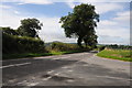
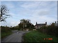
Chweffordd ("Six Roads")
Strange name for a farm east of Henllan - I can only count three roads
Image: © Eirian Evans
Taken: 25 Feb 2020
0.07 miles
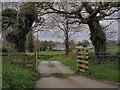
5
Lone cottage near Henllan
Stone cottage on a side road between Henllan and Denbigh
Image: © Dot Potter
Taken: 6 Nov 2005
0.24 miles