
IMAGES TAKEN NEAR TO
Llanrhaeadr, DENBIGH, LL16 4NN
Introduction
This page details the photographs taken nearby to LL16 4NN by members of the Geograph project.
The Geograph project started in 2005 with the aim of publishing, organising and preserving representative images for every square kilometre of Great Britain, Ireland and the Isle of Man.

There are currently over 7.5m images from over14,400 individuals and you can help contribute to the project by visiting https://www.geograph.org.uk
Image Map
Images are licensed for reuse under creativecommons.org/licenses/by-sa/2.0
Notes
- Clicking on the map will re-center to the selected point.
- The higher the marker number, the further away the image location is from the centre of the postcode.
Image Listing (51 Images Found)
Images are licensed for reuse under creativecommons.org/licenses/by-sa/2.0
Image
Details
Distance
2

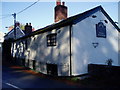
St Dyfnog's Well
The Well is situated behind the graveyard at St. Dyfnog's, a short walk through the woods leads you to a quiet, wooded dell. The water springs from the hillside in several places and collects in a large spa like pool with steps down into the water for the faithfull.
Image: © Eirian Evans
Taken: 7 Jan 2019
0.09 miles
3

St Dyfnog's Well
Another view of the well, Image showing the steps down into the waters.
Image: © Eirian Evans
Taken: 7 Jan 2019
0.09 miles
4

Path to St Dyfnog's Well
The path leads westwards from Llanrhaeadr Church, through a wooded dell for about 300m to reach St Dyfnog's holy well.
Image: © Eirian Evans
Taken: 7 Jan 2019
0.10 miles

6
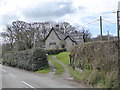
Ty'r Ysgol, Llanrhaeadr yng Nghinmeirch
School House, which was attached to the school building, the latter no longer a school but converted into a house.
Image: © Eirian Evans
Taken: 12 Apr 2016
0.10 miles
7
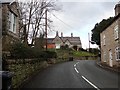
The Old School
At the top of the hill is the former Primary School and school house, now converted to a private house.
Image: © Eirian Evans
Taken: 4 Feb 2019
0.10 miles
8

St Dyfnog's Church, Llanrhaeadr
There has been a church on this site since the 6th century, and the site was chosen because of the holy well which is situated to the west of the church.
Image: © Eirian Evans
Taken: 10 Nov 2007
0.12 miles
9

Almshouses, Llanrhaeadr
To the west of the church in Llanrhaeadr is this row of whitewashed Georgian almshouses. There are three plaques on the walls, the first commemorating the building of the houses in 1729, the second notes that they were restored in 1820 by the 2nd Lord Bagot, and the third notes restoration and modernisation in 1963. The almshouses were originally built and endowed by Jane Jones, (nee Bagot) and the memorial to her husband is inside the church.
Image: © Eirian Evans
Taken: 10 Nov 2007
0.12 miles
10

Memorial to Maurice Jones of Llanrhaeadr Hall
A very imposing memorial to Maurice Jones, who died aged 30 in 1702. It was his wife, Jane Bagot, who built and endowed the almshouses built to the west of the church.
Image: © Eirian Evans
Taken: 10 Nov 2007
0.12 miles