IMAGES TAKEN NEAR TO
Rhewl, RUTHIN, LL15 2UE
Introduction
This page details the photographs taken nearby to LL15 2UE by members of the Geograph project.
The Geograph project started in 2005 with the aim of publishing, organising and preserving representative images for every square kilometre of Great Britain, Ireland and the Isle of Man.

There are currently over 7.5m images from over14,400 individuals and you can help contribute to the project by visiting https://www.geograph.org.uk
Image Map (Loading...)


Getting Data...Please wait
Leaflet Map data © OpenStreetMap
Images are licensed for reuse under creativecommons.org/licenses/by-sa/2.0
Notes
- Clicking on the map will re-center to the selected point.
- The higher the marker number, the further away the image location is from the centre of the postcode.
Image Listing (5 Images Found)
Images are licensed for reuse under creativecommons.org/licenses/by-sa/2.0
Image
Details
Distance
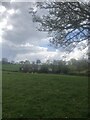
2
Pen-y-Graig
Appropriate name for the farm which translates as Hillcrest. Looking for all the world like a motte and bailey castle.
Image: © Eirian Evans
Taken: 19 Apr 2022
0.17 miles
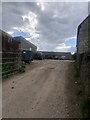
4
Ty Draw
Small farm in the hills south of the River Clywedog
Image: © Eirian Evans
Taken: 19 Apr 2022
0.24 miles