
IMAGES TAKEN NEAR TO
Llwyn Bach, WREXHAM, LL14 6TB
Introduction
This page details the photographs taken nearby to Llwyn Bach, LL14 6TB by members of the Geograph project.
The Geograph project started in 2005 with the aim of publishing, organising and preserving representative images for every square kilometre of Great Britain, Ireland and the Isle of Man.

There are currently over 7.5m images from over14,400 individuals and you can help contribute to the project by visiting https://www.geograph.org.uk
Image Map
Images are licensed for reuse under creativecommons.org/licenses/by-sa/2.0
Notes
- Clicking on the map will re-center to the selected point.
- The higher the marker number, the further away the image location is from the centre of the postcode.
Image Listing (202 Images Found)
Images are licensed for reuse under creativecommons.org/licenses/by-sa/2.0
Image
Details
Distance
1
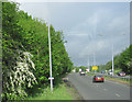
A539 looking west from A483 slip road
The slip road leaves the A483 here at the Ruabon junction.
Image: © John Firth
Taken: 9 May 2011
0.05 miles
2
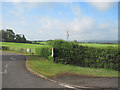
Exit from James Farm caravan site
At junction with A539
Image: © John Firth
Taken: 9 May 2011
0.06 miles
4
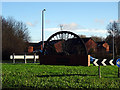
The 'Ruabon Wheel'
A reminder of a mining past. Located on the roundabout on the A539 road, south-west of the town.
Image: © John Lucas
Taken: 14 Jan 2016
0.11 miles
5
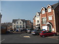
Houses in Gerddi Wynnstay
A recent development in what was the Rhiwabon station sidings, Wynnstay Gardens is a mix of types of houses on 2 & 3 levels. Many have built in garages, but some only have parking places.
Image: © John Haynes
Taken: 24 Mar 2012
0.11 miles
6
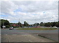
A539 roundabout junction with B5605
To the left is Bridge Street and, on the right of the picture, it's nice to see the 1960's - Ford 105E Anglia - bridging the years .
Image: © Stuart Logan
Taken: 20 Sep 2013
0.11 miles
7
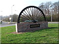
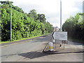
Rhiwabon village sign
This is one of several "colliery" community signs that have been commissioned to commemorate the North East Wales coalfield.
Image]
Image]
Image]
Image: © John Haynes
Taken: 24 Mar 2012
0.11 miles
8
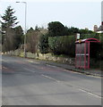
Bridge Street bus stop and shelter, Ruabon
Alongside the B5605 Bridge Street near the Duke Street and Station Road junctions.
Image: © Jaggery
Taken: 27 Feb 2016
0.12 miles
10
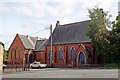
Disused church, Ruabon
Situated on Bridge Street, opposite Station Road, at the junction with Duke Street. The building is of mid 19th-early 20th century red-brick design, and the windows are boarded and bricked up. I think it was a Methodist chapel?
Image: © El Pollock
Taken: 11 Jun 2014
0.13 miles