1
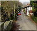
Railway Terrace, Ruabon
The cottages on Railway Terrace date from the mid-19th century. They form part of the Ruabon conservation area.
Image: © Stephen McKay
Taken: 9 May 2019
0.02 miles
2
Stonehurst, Church Street, Ruabon
The 19th century house on the south side of Church Street was Grade II listed in 1995.
Image: © Jaggery
Taken: 27 Feb 2016
0.03 miles
3
Ysgoldy Hill cars and houses, Ruabon
On the north side of Bridge Street. Presumably the hilly part of Ysgoldy Hill is out of shot ahead...
Image: © Jaggery
Taken: 27 Feb 2016
0.03 miles
4
West along Church Street, Ruabon
Looking away from the centre of the village along the B5097 Church Street towards Pont Adam.
Image: © Jaggery
Taken: 27 Feb 2016
0.03 miles
5
Garden of Rest, Ruabon
A peaceful haven on Church Street, Ruabon. All around the walls, St Mary's church gravestones are lined up.
Image: © Eirian Evans
Taken: 19 Mar 2008
0.03 miles
6
Garden of Remembrance, Ruabon
Consecrated ground on the north side of Church Street. In 2016, all the headstones http://www.geograph.org.uk/photo/4851426
in this former cemetery have been arranged along the perimeter of the Garden of Remembrance.
Image: © Jaggery
Taken: 27 Feb 2016
0.03 miles
7
Single-storey building, Church Street, Ruabon
Perhaps formerly a shop or other business premises, viewed in late February 2016.
Grade II listed Stonehurst is on the right. http://www.geograph.org.uk/photo/4846636
Image: © Jaggery
Taken: 27 Feb 2016
0.03 miles
8
The Bridge End Inn in the evening
Voted 'Camra Pub of the Year' 2012.
Image: © Row17
Taken: 10 Apr 2012
0.03 miles
9
Headstones at the edge of Ruabon Garden of Remembrance
Headstones in the former cemetery have been arranged along the perimeter wall of the Garden of Remembrance.
Image: © Jaggery
Taken: 27 Feb 2016
0.03 miles
10
Ruabon almshouses
Built in 1711 and endowed by the vicar John Robinson, these almshouses were renovated in 1979.
Image: © Eirian Evans
Taken: 19 Mar 2008
0.03 miles


