
IMAGES TAKEN NEAR TO
The Nurseries, Maes Y Waun, WREXHAM, LL14 5NQ
Introduction
This page details the photographs taken nearby to The Nurseries, Maes Y Waun, LL14 5NQ by members of the Geograph project.
The Geograph project started in 2005 with the aim of publishing, organising and preserving representative images for every square kilometre of Great Britain, Ireland and the Isle of Man.

There are currently over 7.5m images from over14,400 individuals and you can help contribute to the project by visiting https://www.geograph.org.uk
Image Map
Images are licensed for reuse under creativecommons.org/licenses/by-sa/2.0
Notes
- Clicking on the map will re-center to the selected point.
- The higher the marker number, the further away the image location is from the centre of the postcode.
Image Listing (12 Images Found)
Images are licensed for reuse under creativecommons.org/licenses/by-sa/2.0
Image
Details
Distance
2
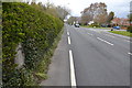
Holyhead 83
Milestone in hedge left-hand side on what would have been the A5 at Chirk, Wrexham; for close up view see http://www.geograph.org.uk/photo/4930425
Image: © Keith Evans
Taken: 30 Apr 2016
0.17 miles
4
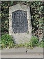
Old Milestone by the B5070, Church Street, Chirk
Telford Plate by the B5070 (was A5), in parish of Chirk (Wrexham County Borough District), Northern approach to Chirk. Often hidden in thick hedge on West side of road.
Inscription reads:-
HOLY-
HEAD
83
LLANGOLLEN
6M-2F
CHIRK-B
0M-5F
Grade II listed by Cadw.
Reference Number: 20236 https://cadwpublic-api.azurewebsites.net/reports/listedbuilding/FullReport?lang=&id=20236
Surveyed
Milestone Society National ID: DEN_HH83
Image: © Milestone Society
Taken: Unknown
0.18 miles
5
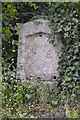
Milestone
Milestone without its cast iron plaque on what would have been the A5 at Chirk, Wrexham; for overall view see http://www.geograph.org.uk/photo/4930430
Image: © Keith Evans
Taken: 30 Apr 2016
0.18 miles
7

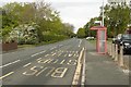
Footpath from Station Road
A narrow pathway north of light industrial units and the football club, which links Station Road with Holyhead Road (the old A5)
Image: © Richard Law
Taken: 8 Apr 2026
0.20 miles
8
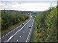
Coming up the bank out of England
Just beyond the over bridge in the distance is the Glyn Ceiriog high bridge which takes the A5 over the Afon Ceiriog which is the Welsh border.
Image: © John Haynes
Taken: 22 Oct 2005
0.21 miles
9
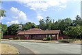
Chirk fire station
At the junction of Lloyd's Lane and Colliery Road
Image: © Eirian Evans
Taken: 19 Jul 2018
0.21 miles
10
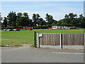
Corner of the outfield
Sports field at Chirk.
Image: © John M
Taken: 17 Jul 2017
0.22 miles