
IMAGES TAKEN NEAR TO
Queen Street, WREXHAM, LL14 1TB
Introduction
This page details the photographs taken nearby to Queen Street, LL14 1TB by members of the Geograph project.
The Geograph project started in 2005 with the aim of publishing, organising and preserving representative images for every square kilometre of Great Britain, Ireland and the Isle of Man.

There are currently over 7.5m images from over14,400 individuals and you can help contribute to the project by visiting https://www.geograph.org.uk
Image Map
Images are licensed for reuse under creativecommons.org/licenses/by-sa/2.0
Notes
- Clicking on the map will re-center to the selected point.
- The higher the marker number, the further away the image location is from the centre of the postcode.
Image Listing (40 Images Found)
Images are licensed for reuse under creativecommons.org/licenses/by-sa/2.0
Image
Details
Distance
1
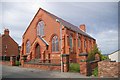
Ebenezer Chapel, Rhosllanerchrugog
This chapel is dated 1907. There weren't any signs of it being used as such, although it appears to be in a good state of repair.
Image: © Peter Craine
Taken: 3 Jun 2008
0.00 miles
2
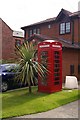
Telephone box greenhouse
Or should it be redhouse?
Image: © Peter Craine
Taken: 3 Jun 2008
0.01 miles
3
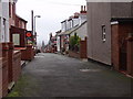
Houses on Stryt Cynlas
Cynlas Street is a small road (which is not on the 1:50000 map) which drops rapidly to the east which affords good views towards the Cheshire Plain. Rail house at Crewe can be seen on a good day Image
Image: © John Haynes
Taken: 10 Nov 2007
0.06 miles
4
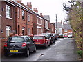
Houses on Rhodfa'r Poplys
Houses of various ages and types on Poplar Avenue.
Image: © John Haynes
Taken: 10 Nov 2007
0.06 miles
5
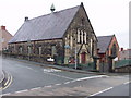
Hill Street Presbyterian Church
An active and well maintained church and church hall.
Image: © John Haynes
Taken: 10 Nov 2007
0.07 miles
6
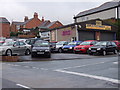
P & G Motors on Stryt yr Allt
There is a car sales area and a small modern workshop.
Image: © John Haynes
Taken: 10 Nov 2007
0.08 miles
7
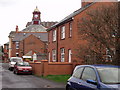
Semi detached houses on Rhodfa'r Poplys
Great pair of red brick houses on Poplar Avenue. The clock above the rooves is atop "The Stiwt" Image
Image: © John Haynes
Taken: 10 Nov 2007
0.08 miles
8
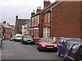
Houses on Stryt y Brenin
The houses on King Street are of various ages. Not in King Street, but stone built houses at the far end. Then a pair of harled (stone dashed) houses, with two pairs of red brick houses. Looking at the nearest house you can see the fronts were built with red facing bricks whereas the side walls were built in commons. These may have been different clay but probably bricks from the edge of the kiln which got "burnt".
Image: © John Haynes
Taken: 10 Nov 2007
0.10 miles
9
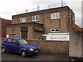
Rhosllannerchrugog telephone exchange
Local exchange with a good line of sight eastwood for the equipment on the roof. 200m from my house so I have good internet connexion.
Image: © John Haynes
Taken: 10 Nov 2007
0.10 miles
10
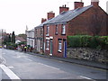
Terrace houses on Stryt yr Allt
Hill Street is one of the main entry roads into the centre of Rhosllannerchrugog, the speed restrictions are in place as the traffic approaches the School.
Image: © John Haynes
Taken: 10 Nov 2007
0.10 miles