
IMAGES TAKEN NEAR TO
Johnson Street, WREXHAM, LL14 1DT
Introduction
This page details the photographs taken nearby to Johnson Street, LL14 1DT by members of the Geograph project.
The Geograph project started in 2005 with the aim of publishing, organising and preserving representative images for every square kilometre of Great Britain, Ireland and the Isle of Man.

There are currently over 7.5m images from over14,400 individuals and you can help contribute to the project by visiting https://www.geograph.org.uk
Image Map
Images are licensed for reuse under creativecommons.org/licenses/by-sa/2.0
Notes
- Clicking on the map will re-center to the selected point.
- The higher the marker number, the further away the image location is from the centre of the postcode.
Image Listing (36 Images Found)
Images are licensed for reuse under creativecommons.org/licenses/by-sa/2.0
Image
Details
Distance
1
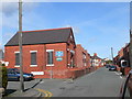
Salvation Army at Rhosllanerchrugog
The church is on New Street, Rhosllanerchrugog. There has been a corps here since 1891.
Image: © Eirian Evans
Taken: 19 Mar 2008
0.02 miles
2
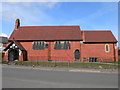
Church in Rhosllanerchrugog
Standing on Broad Street, opposite the health centre.
Image: © Eirian Evans
Taken: 19 Mar 2008
0.03 miles
3
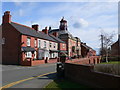
Broad Street, Rhosllanerchrugog
The main road through the middle of Rhosllanerchrugog, the B5097. The "Stiwt" can be seen on the left of the street
Image: © Eirian Evans
Taken: 19 Mar 2008
0.03 miles
4
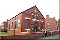
Salvation Army hall, Rhosllanerchrugog
The inscription on the chapel is "Moriah 1887". According to the bible, Mount Moriah was where Isaac was asked to sacrifice his son.
The building is also used for children's playgroups and other community functions.
Image: © Peter Craine
Taken: 3 Jun 2008
0.07 miles
5
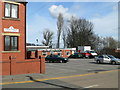
Hafod Colliery Social Club
Off Broad Street, Rhosllanerchrugog.
Image: © Eirian Evans
Taken: 19 Mar 2008
0.08 miles
6
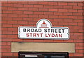
Sign for Broad Street, Rhosllanerchrugog
Cast iron street signs in Rhosllanerchrugog, with a representation of the Stiwt.
Image: © Eirian Evans
Taken: 19 Mar 2008
0.08 miles
7
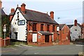
The Coach and Horses
The street sign refers to Vinegar Hill (Allt Ty Gwyn).
Closed 2010 having been run by the Phillips family for generations.
Image: © Richard Hoare
Taken: 8 Oct 2018
0.09 miles
8
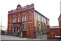
Penuel, Eglwys y Bedyddwyr, Rhosllanerchrugog
Penuel is a place in Jordan, in the Middle East, and it means "face of God".
The church is dated 1859.
Bedyddwyr is Welsh for 'Baptist'.
Image: © Peter Craine
Taken: 3 Jun 2008
0.09 miles
9
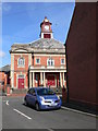
Y Stiwt, Rhosllanerchrugog
This was originally the "Miners' Institute" (Plas Mwynwyr), built in 1926 and which dominated the social and cultural life of the town until 1977 when it closed. The local council, which had bought the building in 1978, decided to demolish the building in 1985, but it was saved as a result of local campaigning. Following fundraising efforts, it was renovated and reopened as a community theatre.
Image: © Eirian Evans
Taken: 19 Mar 2008
0.10 miles
10
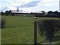
Ysgol y Grango, Rhosllanerchrugog
View of the secondary school as you approach Rhos from the North.
Image: © Eirian Evans
Taken: 19 Mar 2008
0.11 miles