
IMAGES TAKEN NEAR TO
Francis Lane, WREXHAM, LL13 9YP
Introduction
This page details the photographs taken nearby to Francis Lane, LL13 9YP by members of the Geograph project.
The Geograph project started in 2005 with the aim of publishing, organising and preserving representative images for every square kilometre of Great Britain, Ireland and the Isle of Man.

There are currently over 7.5m images from over14,400 individuals and you can help contribute to the project by visiting https://www.geograph.org.uk
Image Map
Images are licensed for reuse under creativecommons.org/licenses/by-sa/2.0
Notes
- Clicking on the map will re-center to the selected point.
- The higher the marker number, the further away the image location is from the centre of the postcode.
Image Listing (47 Images Found)
Images are licensed for reuse under creativecommons.org/licenses/by-sa/2.0
Image
Details
Distance
1
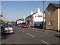
The main street Holt
What used to be the Wrecsam to Nantwich road with a bridge over the Afon Dyfrdwy, between Holt and Farndon.
Image: © John Haynes
Taken: 13 Nov 2005
0.09 miles
2
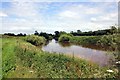
The River Dee/Afon Dyfrdwy near Holt
The River Dee as it flows north towards the village of Holt.
Image: © Jeff Buck
Taken: 5 Jul 2012
0.09 miles
3
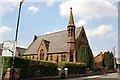
Glan-y-Pwll Presbyterian Church, Holt
Glan-y-Pwll Presbyterian Church on Castle Street.
Image: © Jeff Buck
Taken: 7 May 2013
0.12 miles
4
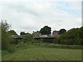
Bypass bridge
This carries the A534 Crewe - Wrexham road past the villages of Farndon and Holt, avoiding the necessity for heavy traffic to continue to use the medieval bridge which links the two villages.
Image: © Alan Murray-Rust
Taken: 9 Jun 2009
0.13 miles
5
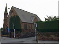
Presbyterian church, Holt
Opened on Christmas Day, 1855.
Image: © Eirian Evans
Taken: 17 Sep 2008
0.13 miles
6
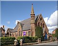
Glan-y-Pwll Presbyterian Church, Holt
If I've identified this correctly, this was built around 1834 and closed in 1971.
Image: © Peter Craine
Taken: 3 Mar 2007
0.13 miles
7
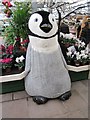
A Christmas Penguin in Bellis Brothers Farm Shop, Holt
A giant baby penguin, part of the christmas decorations in Bellis Brothers Farm Shop, Holt.
Image: © Jeff Buck
Taken: 27 Dec 2013
0.16 miles
8
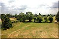
View from Holt Castle
Looking south from Holt Castle.
Wikipedia: https://en.wikipedia.org/wiki/Holt_Castle
Image: © Jeff Buck
Taken: 6 Jul 2018
0.17 miles
9
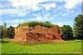
Holt Castle
The south west corner of Holt Castle.
Holt castle was started by Edward I on a sandstone base next to the River Dee soon after the invasion of North Wales in 1277. In 1282 Edward I presented the Welsh lands in which Holt was situated to loyal lord John de Warrene, who was also given the task of completing the castle. By 1311 the castle had been finished and a planned town laid out next to it for the use by English settlers.
A century later, Welsh forces burned down the town in 1400 during the uprising of Owain Glyndŵr although the castle was not taken.
By the 16th century Holt Castle had fallen disuse and ruin. The English Elizabethan map maker John Norden surveyed the castle and noted that it was "nowe in great decay".
In 1643, during the English Civil War Holt was garrisoned by Royalists troops. Three years later, after holding out for a year during a second siege, Holt became the last castle to be captured by Parliamentarian forces in north-east Wales. Holt Castle was slighted in 1650 to stop it being used as a fortification by any royalist supporters.
Between 1675 and 1683 much of the castle was taken away by Sir Thomas Grosvenor, 3rd Baronet of Eaton, who used barges to carry the stonework downstream to rebuild Eaton hall after the English Civil War.
In the 18th century all that remained of Holt Castle was part of a tower and a rectangular building. Today the only sizeable part of Holt Castle that remains is the sandstone base. However a few masonry features are still visible, like the postern gate, a buttress and the foundations of a square tower.
The same view of Holt Castle after restoration Image]
Wikipedia http://en.wikipedia.org/wiki/Holt_Castle
Image: © Jeff Buck
Taken: 5 Jul 2012
0.19 miles
10
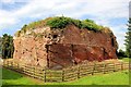
Holt Castle
The south west corner of Holt Castle.
Holt castle was started by Edward I on a sandstone base next to the River Dee soon after the invasion of North Wales in 1277. In 1282 Edward I presented the Welsh lands in which Holt was situated to loyal lord John de Warrene, who was also given the task of completing the castle. By 1311 the castle had been finished and a planned town laid out next to it for the use by English settlers.
A century later, Welsh forces burned down the town in 1400 during the uprising of Owain Glyndŵr although the castle was not taken.
By the 16th century Holt Castle had fallen disuse and ruin. The English Elizabethan map maker John Norden surveyed the castle and noted that it was "nowe in great decay".
In 1643, during the English Civil War Holt was garrisoned by Royalists troops. Three years later, after holding out for a year during a second siege, Holt became the last castle to be captured by Parliamentarian forces in north-east Wales. Holt Castle was slighted in 1650 to stop it being used as a fortification by any royalist supporters.
Between 1675 and 1683 much of the castle was taken away by Sir Thomas Grosvenor, 3rd Baronet of Eaton, who used barges to carry the stonework downstream to rebuild Eaton hall after the English Civil War.
In the 18th century all that remained of Holt Castle was part of a tower and a rectangular building. Today the only sizeable part of Holt Castle that remains is the sandstone base. However a few masonry features are still visible, like the postern gate, a buttress and the foundations of a square tower.
Wikipedia http://en.wikipedia.org/wiki/Holt_Castle
Image: © Jeff Buck
Taken: 5 Jul 2012
0.19 miles