
IMAGES TAKEN NEAR TO
Buck Road, Commonwood, WREXHAM, LL13 9TF
Introduction
This page details the photographs taken nearby to Buck Road, Commonwood, LL13 9TF by members of the Geograph project.
The Geograph project started in 2005 with the aim of publishing, organising and preserving representative images for every square kilometre of Great Britain, Ireland and the Isle of Man.

There are currently over 7.5m images from over14,400 individuals and you can help contribute to the project by visiting https://www.geograph.org.uk
Image Map
Images are licensed for reuse under creativecommons.org/licenses/by-sa/2.0
Notes
- Clicking on the map will re-center to the selected point.
- The higher the marker number, the further away the image location is from the centre of the postcode.
Image Listing (6 Images Found)
Images are licensed for reuse under creativecommons.org/licenses/by-sa/2.0
Image
Details
Distance
1
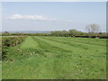
A 5 acre allotment on Commonwood, near Holt
The Commonwood allotments was an area of woodland for villages to graze livestock and collect firewood from the early part of the 14th century onwards. In 1851 Commonwood was enclosed and divided into 65 allotments of approx. 2.7 acres.
http://www.wrexham.gov.uk/english/leisure_tourism/prow/news_articles/commonwood_footpath.htm
My thanks to Gerald England for this information and link.
Image: © John Haynes
Taken: 29 Apr 2006
0.09 miles
2
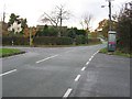
Road Junction with Borras Road and Buck Road
The minor road from Holt to Borras.
Image: © John S Turner
Taken: 19 Nov 2006
0.17 miles
4
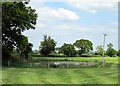
Pond off Borras Road
Just visible on the right side of the pond is an angler.
Image: © Jeff Buck
Taken: 3 Jun 2013
0.21 miles
5
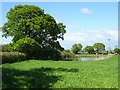
Grazing and pond near Commonwood
Off Borras Road.
Image: © JThomas
Taken: 4 May 2019
0.21 miles
6
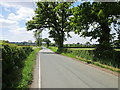
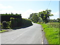
Borras Road heading West
Borras Road heading west towards Borras.
Image: © Jeff Buck
Taken: 3 Jun 2013
0.23 miles