IMAGES TAKEN NEAR TO
Chester Street, WREXHAM, LL13 8TJ

Introduction

This page details the photographs taken nearby to Chester Street, LL13 8TJ by members of the Geograph project.

The Geograph project started in 2005 with the aim of publishing, organising and preserving representative images for every square kilometre of Great Britain, Ireland and the Isle of Man.

There are currently over 7.5m images from over14,400 individuals and you can help contribute to the project by visiting https://www.geograph.org.uk

Image Map


Images are licensed for reuse under creativecommons.org/licenses/by-sa/2.0
Notes
  • Clicking on the map will re-center to the selected point.
  • The higher the marker number, the further away the image location is from the centre of the postcode.

Image Listing (255 Images Found)

Images are licensed for reuse under creativecommons.org/licenses/by-sa/2.0
  • ...
Image
Details
Distance
1
Bench mark in Chester Street, Wrexham
This bench mark is on a low wall on the west side of Chester Street; a few metres north of the Baptist Church.
Image: © John S Turner Taken: 5 Jan 2015
0.01 miles
2
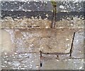
Ordnance Survey Cut Mark
This OS cut mark can be found on the wall west side of Chester Road. It marks a point 84.725m above mean sea level.
Image: © Adrian Dust Taken: 22 Oct 2021
0.01 miles
3
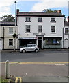
Dragon Clothing Company, Wrexham
Located in Wingett House, Chester Street.
Image: © Jaggery Taken: 24 Sep 2016
0.03 miles
4
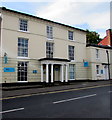
Old Registry, Wrexham
In September 2016 the Old Registry at 23 Chester Street is the office of lawyers Slater Gordon. Built as a house in the early 18th century, later the District Register Office. Grade II listed in 1980.
Image: © Jaggery Taken: 24 Sep 2016
0.04 miles
5
Milepost plate in Chester Road, Wrexham: "To Chester M 11"
This old milestone plate is set into the wall on the west side of Chester Road, Wrexham, opposite the war memorial. The O.S. maps show the milepost on the east side of the road from 1874 onwards, then on the 1958 map it has moved to the west side of the road. Presumably it was moved to make way for the war memorial. The view across the road Image
Image: © John S Turner Taken: 21 May 2018
0.06 miles
6
Traffic island and milepost in Chester Road, Wrexham
Looking across Chester Road towards the milepost "To Chester M 11" - Image
Image: © John S Turner Taken: 15 May 2018
0.06 miles
7
Saith Seren pub in Wrexham
The Lambpit Street side of the town centre pub on the corner of Chester Street, viewed in September 2016. An August 2009 Google Earth Street View shows the name as Seven Stars, the English equivalent of the Welsh Saith Seren.
Image: © Jaggery Taken: 24 Sep 2016
0.06 miles
8
Wrexham Library
This building at Queens Square, designed by Vernon Hodge, was the Wrexham Borough Library from 1906 until 1973, when it was transferred to Llwyn Isaf. It is adjacent to the Tourist Information Centre. (Right of shot).
Image: © Roger May Taken: 15 Oct 2005
0.06 miles
9
Tesco Extra
Image: © Mr M Evison Taken: 19 Apr 2006
0.06 miles
10
Wrexham Swimming Bath
Image: © Mr M Evison Taken: 19 Apr 2006
0.06 miles
  • ...