
IMAGES TAKEN NEAR TO
Ellice Way, WREXHAM, LL13 7YT
Introduction
This page details the photographs taken nearby to Ellice Way, LL13 7YT by members of the Geograph project.
The Geograph project started in 2005 with the aim of publishing, organising and preserving representative images for every square kilometre of Great Britain, Ireland and the Isle of Man.

There are currently over 7.5m images from over14,400 individuals and you can help contribute to the project by visiting https://www.geograph.org.uk
Image Map
Images are licensed for reuse under creativecommons.org/licenses/by-sa/2.0
Notes
- Clicking on the map will re-center to the selected point.
- The higher the marker number, the further away the image location is from the centre of the postcode.
Image Listing (23 Images Found)
Images are licensed for reuse under creativecommons.org/licenses/by-sa/2.0
Image
Details
Distance
1
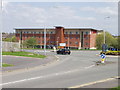
New Ramada Hotel, Wrecsam
Close to the by-pass, the technology park, football ground, and the railway station. Ideal place for a hotel!
Image: © John Haynes
Taken: 29 Apr 2006
0.13 miles
2
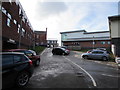
Wrexham Maelor Hospital
The northwest corner of the hospital site viewed from the southern end of Maesgwyn Road.
Image: © Jaggery
Taken: 12 Feb 2018
0.17 miles
3
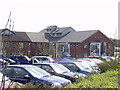
Ysbyty Maelor Wrecsam. (Wrexham Maelor Hospital)
Latest addition to this ever growing modern hospital. http://www.newalesnhstrust.org.uk/index.php?page=wrexhamhospital&lang=en
Image: © John Haynes
Taken: 29 Apr 2006
0.17 miles
4
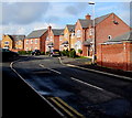
Plas y Ffynnon houses, Wrexham
Houses built in the second decade of the 21st century viewed from the corner of Maesgwyn Road.
Image: © Jaggery
Taken: 12 Feb 2018
0.18 miles
5
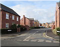
Plas y Ffynnon, Wrexham
Houses built in the second decade of the 21st century viewed across Maesgwyn Road.
Image: © Jaggery
Taken: 12 Feb 2018
0.19 miles
6
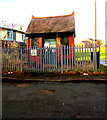
Maesgwyn Waste Water Pumping Station, Wrexham
The Welsh Water site is alongside Maesgwyn Road near this entrance https://www.geograph.org.uk/photo/5694123 to Wrexham Maelor Hospital.
Notices show Please Keep Clear - No Parking - 24 hour access required
and Potentially explosive atmospheres exist on this site.
Image: © Jaggery
Taken: 12 Feb 2018
0.19 miles
7
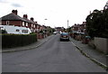
Belvedere Drive, Wrexham
Viewed from the Berse Road end looking along Belvedere Drive towards the Windsor Drive junction.
Image: © Jaggery
Taken: 24 Sep 2016
0.19 miles
8
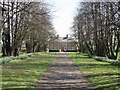
Croesnewydd Hall, Wrecsam
A beautifully maintained old house used for offices.
Image: © John Haynes
Taken: 29 Apr 2006
0.19 miles
9
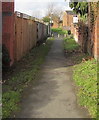
Public footpath from Maesgwyn Road, Wrexham
Towards Primrose Way and Lilac Way.
Image: © Jaggery
Taken: 12 Feb 2018
0.20 miles
10
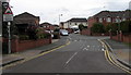
Yale Park, Wrexham
Cul-de-sac on the south side of the A541 Mold Road.
The sign on the left warns of humps across the road for 190 yards ahead.
Image: © Jaggery
Taken: 24 Sep 2016
0.22 miles