
IMAGES TAKEN NEAR TO
Abbey Gardens, WREXHAM, LL13 0DZ
Introduction
This page details the photographs taken nearby to Abbey Gardens, LL13 0DZ by members of the Geograph project.
The Geograph project started in 2005 with the aim of publishing, organising and preserving representative images for every square kilometre of Great Britain, Ireland and the Isle of Man.

There are currently over 7.5m images from over14,400 individuals and you can help contribute to the project by visiting https://www.geograph.org.uk
Image Map
Images are licensed for reuse under creativecommons.org/licenses/by-sa/2.0
Notes
- Clicking on the map will re-center to the selected point.
- The higher the marker number, the further away the image location is from the centre of the postcode.
Image Listing (67 Images Found)
Images are licensed for reuse under creativecommons.org/licenses/by-sa/2.0
Image
Details
Distance
1
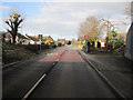
Overton Road into Bangor-is-y-coed
Looking along the B5069, Overton Road, from underneath the Bangor-is-y-coed by-pass. The edge of the grid square crosses the road diagonally just beyond the 30mph signs.
Image: © John S Turner
Taken: 27 Feb 2011
0.11 miles
2
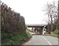
A525 overbridge from B5069
Entering Bangor on Dee
Image: © John Firth
Taken: 12 Apr 2014
0.12 miles
3

Underneath the new A525 bridge at Bangor-is-y-coed
Bangor-is-y-coed was by-passed in 1978, and this bridge carries the new section of the A525 over the Afon Dyfrdwy/River Dee. Although a path seems to continue along the riverbank, the O.S. map indicates that the public footpath turns left here to join the minor road.
Image: © John S Turner
Taken: 27 Feb 2011
0.12 miles
4
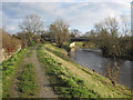
The riverbank and new bridge at Bangor-is-y-coed
Looking along the riverside at Bangor-is-y-coed/Bangor-on-Dee. The bridge in the distance is the A525 by-pass bridge that was built in 1978.
Image: © John S Turner
Taken: 27 Feb 2011
0.12 miles
5
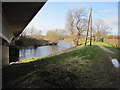
Afon Dyfrdwy/River Dee at Bangor-is-y-coed
A view of the river downstream from under the A525 by-pass bridge.
Image: © John S Turner
Taken: 27 Feb 2011
0.13 miles
6
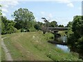
Bangor By-pass Bridge
The by-pass bridge oat Bangor-on-Dee/Bangor-is-y-Coed on the A525 was built in 1978 to relieve pressure on the original medieval bridge a short way downstream which was completely inadequate to cope with modern traffic.
Image: © Oliver Dixon
Taken: 29 Jun 2023
0.13 miles
7

Bangor-on-Dee bypass bridge
A525 bridge over the river Dee
Image: © Jim Thornton
Taken: Unknown
0.14 miles
8
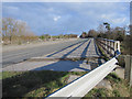
The A525 Bridge over the Afon Dyfrdwy/River Dee
Looking across the A525 river bridge that by-passes Bangor-is-y-coed/Bangor-on-Dee. The by-pass opened in 1978.
Image: © John S Turner
Taken: 27 Feb 2011
0.14 miles
9
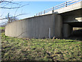
Bridge abutment on the A525
This bridge was built in 1978 to carry the Bangor-is-y-coed by-pass over the Afon Dyfrdwy/River Dee. In times of flood the water level rises dramatically, so I imaging the rounded shape of the bridge abutment is to deflect the pressure of flood water - note the water level gauge. Further to the north-west there is a series of drainage channels through the embankment, again to relieve the pressure of raised water levels.
Image: © John S Turner
Taken: 27 Feb 2011
0.16 miles
10
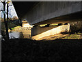
Under the A525 by-pass bridge
The Bangor-is-y-coed/Bangor-on-Dee by-pass was opened in 1978, and this is the bridge over the Afon Dyfrdwy/River Dee.
Image: © John S Turner
Taken: 27 Feb 2011
0.16 miles