
IMAGES TAKEN NEAR TO
Bryn Yorkin, WREXHAM, LL12 9HU
Introduction
This page details the photographs taken nearby to Bryn Yorkin, LL12 9HU by members of the Geograph project.
The Geograph project started in 2005 with the aim of publishing, organising and preserving representative images for every square kilometre of Great Britain, Ireland and the Isle of Man.

There are currently over 7.5m images from over14,400 individuals and you can help contribute to the project by visiting https://www.geograph.org.uk
Image Map
Images are licensed for reuse under creativecommons.org/licenses/by-sa/2.0
Notes
- Clicking on the map will re-center to the selected point.
- The higher the marker number, the further away the image location is from the centre of the postcode.
Image Listing (137 Images Found)
Images are licensed for reuse under creativecommons.org/licenses/by-sa/2.0
Image
Details
Distance
1
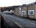
Bryn Yorkin, Caergwrle, Flintshire
A view to the southwest from High Street along the road named Bryn Yorkin.
Image: © Jaggery
Taken: 29 Jan 2018
0.04 miles
2

No parking in Ty Cerrig, Caergwrle, Flintshire
Double yellow lines on both sides of the narrow street named Ty Cerrig indicate no parking at any time.
Image: © Jaggery
Taken: 29 Jan 2018
0.08 miles
3
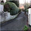
Lane on the west side of High Street, Caergwrle, Flintshire
Signs behind the camera show No motor vehicles except for access. https://www.geograph.org.uk/photo/5668270
Image: © Jaggery
Taken: 29 Jan 2018
0.09 miles
4
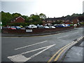
Car park in Caergwrle
A very convenient free car park for the shops and for walkers.
Image: © Jeremy Bolwell
Taken: 16 May 2011
0.10 miles
5
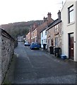
Gwalia, Caergwrle, Flintshire
Gwalia is a dead-end street on the southwest side of High Street.
Image: © Jaggery
Taken: 29 Jan 2018
0.10 miles
6
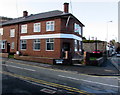
Former HSBC bank branch, Caergwrle, Flintshire
On the corner of High Street and Ty Cerrig, viewed in January 2018.
The branch closed down in December 2016. Accounts held here were transferred to HSBC Wrexham.
Image: © Jaggery
Taken: 29 Jan 2018
0.10 miles
7
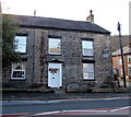
Ty Cerrig residential care home, Caergwrle, Flintshire
At 27 High Street, on the corner of the street named Ty Cerrig.
Image: © Jaggery
Taken: 29 Jan 2018
0.10 miles
8
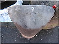
Rivet bench mark on old milestone in Caergwrle High Street
This bench mark, which is recorded on the O.S. maps as early as 1879, is on the top of an old milestone that once read 'Mold 6 Wrexham 5'. Today the milestone is illegible, and the bench mark is no longer recorded on the O.S database.
Benchmark Database: https://www.bench-marks.org.uk/bm33194
Image: © John S Turner
Taken: 21 Feb 2010
0.10 miles
9
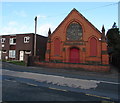
Former Methodist Chapel, High Street, Caergwrle, Flintshire
The foundation stones show the year 1899. In January 2018, Caergwrle's Methodist Church is in Castle Street. https://www.geograph.org.uk/photo/5665720
Image: © Jaggery
Taken: 29 Jan 2018
0.10 miles
10
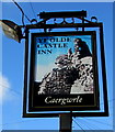
Ye Olde Castle Inn name sign, Caergwrle, Flintshire
On a metal post in the car park of this https://www.geograph.org.uk/photo/5668173 High Street pub.
Image: © Jaggery
Taken: 29 Jan 2018
0.10 miles