
IMAGES TAKEN NEAR TO
Hawarden Road, WREXHAM, LL12 9BQ
Introduction
This page details the photographs taken nearby to Hawarden Road, LL12 9BQ by members of the Geograph project.
The Geograph project started in 2005 with the aim of publishing, organising and preserving representative images for every square kilometre of Great Britain, Ireland and the Isle of Man.

There are currently over 7.5m images from over14,400 individuals and you can help contribute to the project by visiting https://www.geograph.org.uk
Image Map
Images are licensed for reuse under creativecommons.org/licenses/by-sa/2.0
Notes
- Clicking on the map will re-center to the selected point.
- The higher the marker number, the further away the image location is from the centre of the postcode.
Image Listing (60 Images Found)
Images are licensed for reuse under creativecommons.org/licenses/by-sa/2.0
Image
Details
Distance
1
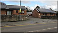
Old School Court, Caergwrle, Flintshire
Bungalows on the east side of the A550 Hawarden Road.
Image: © Jaggery
Taken: 29 Jan 2018
0.02 miles
2
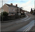
Warning sign 13' 3 headroom bridge half a mile ahead, Hawarden Road, Caergwrle, Flintshire
The sign faces the A550 Hawarden Road near the A541 Wrexham Road junction,
half a mile from this https://www.geograph.org.uk/photo/5665714 Borderlands Line railway bridge.
Image: © Jaggery
Taken: 29 Jan 2018
0.03 miles
3
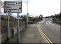
A541 directions sign facing the A550, Caergwrle, Flintshire
Facing southbound traffic on the A550 Hawarden Road. In Welsh, Wrexham is Wrecsam and Mold is Yr Wyddgrug, literally the prominent mound. The same name is found in Gwyddgrug, a location in Carmarthenshire and also in Radnorshire. A similar name is the Welsh for Snowdon, Yr Wyddfa meaning the prominent place.
Image: © Jaggery
Taken: 29 Jan 2018
0.03 miles
4
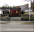
Hawarden Road electricity substation, Caergwrle, Flintshire
Set back from the west side of the A550 Hawarden Road near the A541 Wrexham Road junction.
Image: © Jaggery
Taken: 29 Jan 2018
0.04 miles
6
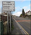
A550 distances sign, Hawarden Road, Caergwrle, Flintshire
Facing northbound traffic 3 miles from Pen-y-ffordd, 7 from Hawarden (Penarlâg in Welsh), 8 from Queensferry.
Image: © Jaggery
Taken: 29 Jan 2018
0.04 miles
7
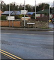
Wrexham Road direction signs near Abermorddu, Flintshire
Left on the A541 for Mold (Yr Wyddgrug in Welsh), right for Wrexham (Wrecsam in Welsh).
The houses in the background are alongside the A550 Hawarden Road.
Image: © Jaggery
Taken: 29 Jan 2018
0.04 miles
8
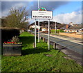
Welcome to / Croeso i / Abermorddu
Alongside the A541 Wrexham Road near the Cymau Lane junction and the A550 Hawarden Road junction.
Abermorddu is a village in Flintshire c8km north of Wrexham. Nearby villages are Cefn-y-Bedd, Caergwrle and Hope.
Image: © Jaggery
Taken: 29 Jan 2018
0.05 miles
9
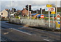
Wrexham Road pelican crossing, Caergwrle, Flintshire
Across the A541 Wrexham Road near the A550 Hawarden Road junction.
Image: © Jaggery
Taken: 29 Jan 2018
0.05 miles
10
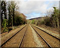
Borderlands Line north from Cefn-y-bedd station, Flintshire
Viewed from this https://www.geograph.org.uk/photo/5667483 level crossing. Next station ahead is Caergwrle on the Borderlands Line to Bidston.
Image: © Jaggery
Taken: 29 Jan 2018
0.05 miles