IMAGES TAKEN NEAR TO
Gresford Industrial Park, Chester Road, WREXHAM, LL12 8LX
Introduction
This page details the photographs taken nearby to Gresford Industrial Park, Chester Road, LL12 8LX by members of the Geograph project.
The Geograph project started in 2005 with the aim of publishing, organising and preserving representative images for every square kilometre of Great Britain, Ireland and the Isle of Man.

There are currently over 7.5m images from over14,400 individuals and you can help contribute to the project by visiting https://www.geograph.org.uk
Image Map
Images are licensed for reuse under creativecommons.org/licenses/by-sa/2.0
Notes
- Clicking on the map will re-center to the selected point.
- The higher the marker number, the further away the image location is from the centre of the postcode.
Image Listing (19 Images Found)
Images are licensed for reuse under creativecommons.org/licenses/by-sa/2.0
Image
Details
Distance
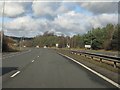
3
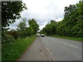
Chester Road (B5445) towards Wrexham
Looking south west.
Image: © JThomas
Taken: 25 May 2019
0.11 miles
6
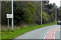
B5445, Chester Road, near Pandy
The B5445 was formerly a 6½ stretch of the old route of the A483 before that road was rerouted to bypass Gresford and this road was renumbered. It begins at the Gresford Interchange and ends at Belgrave Bridge where it rejoins the current A483.
Image: © David Dixon
Taken: 15 Apr 2016
0.15 miles
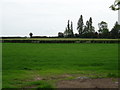
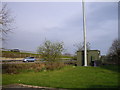
8
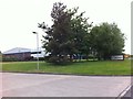
Gresford Colliery Sports and Social Club
Image: © Richard Hoare
Taken: 7 Jun 2018
0.17 miles
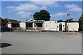
10
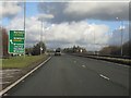
A483 at junction 6 (A5156)
Curiously, the A5156 route number for Nantwich does not feature at all, that for the A534, the main west-east road across Cheshire with which it soon connects being preferred.
Image: © Peter Whatley
Taken: 18 Jan 2011
0.20 miles