
IMAGES TAKEN NEAR TO
Borras Road, WREXHAM, LL12 7EN
Introduction
This page details the photographs taken nearby to Borras Road, LL12 7EN by members of the Geograph project.
The Geograph project started in 2005 with the aim of publishing, organising and preserving representative images for every square kilometre of Great Britain, Ireland and the Isle of Man.

There are currently over 7.5m images from over14,400 individuals and you can help contribute to the project by visiting https://www.geograph.org.uk
Image Map
Images are licensed for reuse under creativecommons.org/licenses/by-sa/2.0
Notes
- Clicking on the map will re-center to the selected point.
- The higher the marker number, the further away the image location is from the centre of the postcode.
Image Listing (7 Images Found)
Images are licensed for reuse under creativecommons.org/licenses/by-sa/2.0
Image
Details
Distance
1
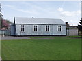
Methodist Church, Rhosnesni, Wrecsam
A well maintained "Tin Chapel".
Image: © John Haynes
Taken: 29 Apr 2006
0.11 miles
2
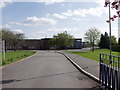
Rhosnesni High School, Wrecsam
Modern community High School.
Image: © John Haynes
Taken: 29 Apr 2006
0.15 miles
3
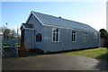
Tin Tabernacle
One of the many such churches or chapels which sprang up following the invention of corrugated iron in the early 19th Century. This is the Methodist chapel in Rhosnensi.
Image: © Geoff Evans
Taken: 30 Jan 2008
0.20 miles
4
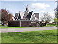
St John's Church, Rhosnesni, Wrecsam
Ultra modern church standing on the edge of a great open space, once part of Acton Park.
Image: © John Haynes
Taken: 29 Apr 2006
0.21 miles
6
Stryt Holt (Holt Road), Wrexham
Looking south west on the A534.
Image: © JThomas
Taken: 4 May 2019
0.24 miles
7
Gate Hangs High, Rhosnesni, Wrecsam
Old pub situated within relatively modern housing.
Image: © John Haynes
Taken: 29 Apr 2006
0.25 miles