
IMAGES TAKEN NEAR TO
Townsditch, WREXHAM, LL12 0AN
Introduction
This page details the photographs taken nearby to Townsditch, LL12 0AN by members of the Geograph project.
The Geograph project started in 2005 with the aim of publishing, organising and preserving representative images for every square kilometre of Great Britain, Ireland and the Isle of Man.

There are currently over 7.5m images from over14,400 individuals and you can help contribute to the project by visiting https://www.geograph.org.uk
Image Map
Images are licensed for reuse under creativecommons.org/licenses/by-sa/2.0
Notes
- Clicking on the map will re-center to the selected point.
- The higher the marker number, the further away the image location is from the centre of the postcode.
Image Listing (8 Images Found)
Images are licensed for reuse under creativecommons.org/licenses/by-sa/2.0
Image
Details
Distance
1

Stringers Lane at Town Ditch
Town Ditch over the border into Wrexham. On the right is Oak Tree Farm.
Image: © Jeff Buck
Taken: 2 May 2013
0.03 miles
2
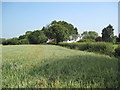
Town Ditch Farm Buildings and Footpath
The footpath moves along the hedge to the lane. The hedge acts as the border between Flintshire and Wrexham county councils.
Image: © David Quinn
Taken: 29 Jun 2009
0.04 miles
3
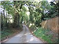
Lane at Town Ditch
Looking North down the lane at Town Ditch. In the distance the lane veers right as it crosses into SJ 3259.
Image: © John S Turner
Taken: 7 Nov 2006
0.06 miles
4
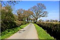
Stringers Lane near Town Ditch
Near Oak Tree Farm.
Image: © Jeff Buck
Taken: 2 May 2013
0.12 miles
5
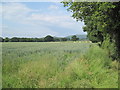
Farmland near Hope
Hope Mountain is in the background.
Image: © David Quinn
Taken: 29 Jun 2009
0.20 miles
6
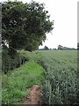
View of Footpath to Town Ditch
The footpath moves into a field of crop and follows the ridge of grass along the field.
Image: © David Quinn
Taken: 29 Jun 2009
0.20 miles
7
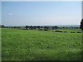
Farmland and view into Cheshire
Photograph was taken at the junction of 2 footpaths leading to Stringer's Lane near Honkley. Much of Cheshire was visible, including Helsby Hill, Chester and Beeston Castle.
Image: © David Quinn
Taken: 29 Jun 2009
0.23 miles
8
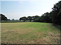
Farmland near Hope
I think this field is used as grazing for horses. The footpath bisects this field, moving to the north-east corner.
Image: © David Quinn
Taken: 29 Jun 2009
0.24 miles