
IMAGES TAKEN NEAR TO
Main Road, WREXHAM, LL11 6UE
Introduction
This page details the photographs taken nearby to Main Road, LL11 6UE by members of the Geograph project.
The Geograph project started in 2005 with the aim of publishing, organising and preserving representative images for every square kilometre of Great Britain, Ireland and the Isle of Man.

There are currently over 7.5m images from over14,400 individuals and you can help contribute to the project by visiting https://www.geograph.org.uk
Image Map
Images are licensed for reuse under creativecommons.org/licenses/by-sa/2.0
Notes
- Clicking on the map will re-center to the selected point.
- The higher the marker number, the further away the image location is from the centre of the postcode.
Image Listing (17 Images Found)
Images are licensed for reuse under creativecommons.org/licenses/by-sa/2.0
Image
Details
Distance
1
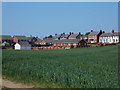
A mix of new and older houses in Caego
Every available space has been used for housing in this area, this field of wheat has a clearly defined path running alongside the old railway line, presumably to help with the dog walking pressure. (bottom left in picture)
Image: © John Haynes
Taken: 6 Jun 2016
0.11 miles
2
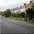
Row of houses, New Broughton
Viewed across the B5101 Berse Road.
Image: © Jaggery
Taken: 24 Sep 2016
0.13 miles
3
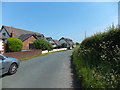
Several relatively new houses
These houses have been built on a strip of land between the road and an uplifted railway line.
Image: © John Haynes
Taken: 6 Jun 2016
0.13 miles
4
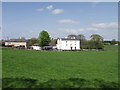
Gatewen Hall, New Broughton, near Wrecsam
Well maintained country house.
Image: © John Haynes
Taken: 29 Apr 2006
0.14 miles
5
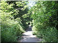
Old railway cycle track
The trees, bushes and wild plants that line this pathway are amazing.
Image: © John Haynes
Taken: 6 Jun 2016
0.15 miles
6
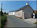
Lower Mill Farm
The house looks as if it has recently been gentrified.
Image: © John Haynes
Taken: 6 Jun 2016
0.15 miles
7
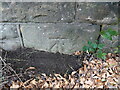
Benchmark on Berse Road bridge, Caego, Wrexham
Ordnance Survey benchmark on the north parapet of the former railway bridge, Berse Road, Caego, Wrexham. Levelled at 111.721m above Newlyn Datum, verified 1959. For a wider view see: Image
Benchmark database: https://www.bench-marks.org.uk/bm197662
Image: © John S Turner
Taken: 15 Jul 2023
0.17 miles
8
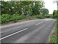
Berse Road bridge, Caego, Wrexham
Looking east across the former railway bridge in Berse Road, Caego; the track bed is now a public footpath. There is an Ordnance Survey benchmark on the north parapet where there is a dark line on the left of the photo: Image
Image: © John S Turner
Taken: 15 Jul 2023
0.18 miles
9
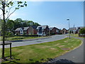
The all new Gatewen Village
Bloor Homes have built a large housing estate at Gatewen, this is the entrance road into the complex.
https://bloorhomes.com/developments/north-west/gatewen-village
Image: © John Haynes
Taken: 6 Jun 2016
0.18 miles
10
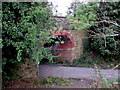
South side of a former railway bridge, New Broughton
A combined cycleway and footpath on the former trackbed of a dismantled railway pass under Berse Road.
Image: © Jaggery
Taken: 24 Sep 2016
0.18 miles