1
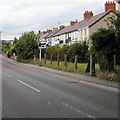
Several relatively new houses
These houses have been built on a strip of land between the road and an uplifted railway line.
Image: © John Haynes
Taken: 6 Jun 2016
0.05 miles
2
Lower Mill Farm
The house looks as if it has recently been gentrified.
Image: © John Haynes
Taken: 6 Jun 2016
0.05 miles
3
A mix of new and older houses in Caego
Every available space has been used for housing in this area, this field of wheat has a clearly defined path running alongside the old railway line, presumably to help with the dog walking pressure. (bottom left in picture)
Image: © John Haynes
Taken: 6 Jun 2016
0.09 miles
4
Houses on a road called Green Meadows
A small modern housing development.
Image: © John Haynes
Taken: 6 Jun 2016
0.09 miles
5
Row of houses, New Broughton
Viewed across the B5101 Berse Road.
Image: © Jaggery
Taken: 24 Sep 2016
0.16 miles
6
Zoar Chapel, New Broughton, Wrexham
Photo December 7, 2003 No longer there.
Image: © David Williams
Taken: 7 Dec 2003
0.16 miles
7
Old railway cycle track
The trees, bushes and wild plants that line this pathway are amazing.
Image: © John Haynes
Taken: 6 Jun 2016
0.19 miles
8
A roadside area of wild ground
Plenty of wild flowers and grasses.
Image: © John Haynes
Taken: 6 Jun 2016
0.19 miles
9
Benchmark on Berse Road bridge, Caego, Wrexham
Ordnance Survey benchmark on the north parapet of the former railway bridge, Berse Road, Caego, Wrexham. Levelled at 111.721m above Newlyn Datum, verified 1959. For a wider view see:
Image
Benchmark database: https://www.bench-marks.org.uk/bm197662
Image: © John S Turner
Taken: 15 Jul 2023
0.20 miles
10
South side of a former railway bridge, New Broughton
A combined cycleway and footpath on the former trackbed of a dismantled railway pass under Berse Road.
Image: © Jaggery
Taken: 24 Sep 2016
0.21 miles


