
IMAGES TAKEN NEAR TO
Old Road, WREXHAM, LL11 5UH
Introduction
This page details the photographs taken nearby to Old Road, LL11 5UH by members of the Geograph project.
The Geograph project started in 2005 with the aim of publishing, organising and preserving representative images for every square kilometre of Great Britain, Ireland and the Isle of Man.

There are currently over 7.5m images from over14,400 individuals and you can help contribute to the project by visiting https://www.geograph.org.uk
Image Map
Images are licensed for reuse under creativecommons.org/licenses/by-sa/2.0
Notes
- Clicking on the map will re-center to the selected point.
- The higher the marker number, the further away the image location is from the centre of the postcode.
Image Listing (8 Images Found)
Images are licensed for reuse under creativecommons.org/licenses/by-sa/2.0
Image
Details
Distance
1
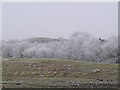
Frozen trees near Bwlchgwyn
The mist had condensed onto the trees and a hard frost makes the trees look like clouds.
Image: © Eirian Evans
Taken: 2 Feb 2006
0.09 miles
2
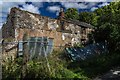
Tan-y-bwlch
Derelict house at Tan-y-bwlch.
Image: © Peter McDermott
Taken: 11 Sep 2016
0.13 miles
3

Peniel Chapel
Dating from 1823, now sadly derelict.
Image: © John H Darch
Taken: 2 Sep 2022
0.18 miles
4
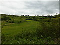
Grassland, shrubs and hedges
A typical non intensive agricultural view, how much of this area would have looked before the changes brought on by intensification.
Image: © John Haynes
Taken: 14 Jun 2016
0.19 miles
5
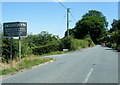
A525 at Bwlchgwyn village boundary, highest village in Wales
Image: © Colin Pyle
Taken: 16 Jul 2021
0.19 miles
6
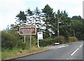
Entrance to Bwlchgwyn village
Claimed to be the highest village in Wales.
Image: © Roger Cornfoot
Taken: 15 Jul 2009
0.20 miles
7

Four Crosses
Fields near Four Crosses.
Image: © Peter McDermott
Taken: 11 Sep 2016
0.21 miles
8
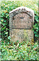
Old Milestone by the A525, Ruthin Road, Brymbo parish
Ruthin Plate by the A525, in parish of Brymbo (Wrexham County Borough District), Four Crosses, East of junction with Nant Road, in bank, West of public footpath.
Inscription reads:-
RUTHIN DISTRICT
WREXHAM 6
RUTHIN 12
Carved bench mark below plate.
Surveyed
Milestone Society National ID: DEN_WRRU06
Image: © Milestone Society
Taken: Unknown
0.21 miles