
IMAGES TAKEN NEAR TO
Cymau, WREXHAM, LL11 5HB
Introduction
This page details the photographs taken nearby to LL11 5HB by members of the Geograph project.
The Geograph project started in 2005 with the aim of publishing, organising and preserving representative images for every square kilometre of Great Britain, Ireland and the Isle of Man.

There are currently over 7.5m images from over14,400 individuals and you can help contribute to the project by visiting https://www.geograph.org.uk
Image Map
Images are licensed for reuse under creativecommons.org/licenses/by-sa/2.0
Notes
- Clicking on the map will re-center to the selected point.
- The higher the marker number, the further away the image location is from the centre of the postcode.
Image Listing (8 Images Found)
Images are licensed for reuse under creativecommons.org/licenses/by-sa/2.0
Image
Details
Distance
1
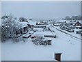
View of Cymau Village in the Snow
Woke up to more snow! 10th March 2023
Image: © Isabel Blore
Taken: 10 Mar 2023
0.11 miles
2
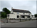
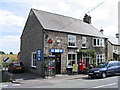
Another pub closed down....
Ye Olde Talbot Inn.
Image: © John H Darch
Taken: 31 May 2018
0.11 miles
4
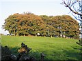
Clump of Trees
This clump of trees, showing their autumn colours, seem to be disguising a prominent mound.
Image: © John S Turner
Taken: 6 Nov 2006
0.18 miles
5

Trees and Field
These trees are the remains of an old boundary that divided this field. (O.S. map 1879)
Image: © John S Turner
Taken: 6 Nov 2006
0.22 miles
7
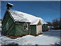
All Saints, Cymau in the snow
Friday 10th March 2023 walked down to check all well at church & empty dehumidifier.
Image: © Isabel Blore
Taken: 10 Mar 2023
0.23 miles
8

Field gate and public footpath
Taken directly into the low afternoon sun, the trio of trees on the brow of the hill throw long shadows as far as the gate and stile.
Image: © John S Turner
Taken: 6 Nov 2006
0.23 miles