IMAGES TAKEN NEAR TO
Sheppard Street, WREXHAM, LL11 5FF

Introduction

This page details the photographs taken nearby to Sheppard Street, LL11 5FF by members of the Geograph project.

The Geograph project started in 2005 with the aim of publishing, organising and preserving representative images for every square kilometre of Great Britain, Ireland and the Isle of Man.

There are currently over 7.5m images from over14,400 individuals and you can help contribute to the project by visiting https://www.geograph.org.uk

Image Map


Images are licensed for reuse under creativecommons.org/licenses/by-sa/2.0
Notes
  • Clicking on the map will re-center to the selected point.
  • The higher the marker number, the further away the image location is from the centre of the postcode.

Image Listing (8 Images Found)

Images are licensed for reuse under creativecommons.org/licenses/by-sa/2.0
Image
Details
Distance
1
Tanyfron Allotments
Tanyfron has 18 half plots and 2 quarter plots.
Image: © Eirian Evans Taken: 9 Feb 2012
0.22 miles
2
Benches and boulders in Lodge near Wrexham
Set back from the B5101 Broughton Road in the village of Lodge.
Image: © Jaggery Taken: 24 Sep 2016
0.23 miles
3
Hall in Lodge near Wrexham
Set back from the B5101 Broughton Road in the village of Lodge.
Image: © Jaggery Taken: 24 Sep 2016
0.24 miles
4
Kent Road bus shelter and telecoms cabinet near the site of the Lodge Village near Wrexham
The information poster on the bus shelter records that the bus stop stands now in what used to be a large thriving community. During the 1960s there were nine shops open for business nearby ranging from groceries to hardware to footwear to fish & chips. Most children attended either Black Lane School or Brymbo Church School. The hub of the Lodge Village was the Post Office run by Mrs Ruth Marshall. The village had grown because of the need to house workers at a nearby steelworks. During the 1960s the steelworks grew larger and required land on which some of Lodge Village stood. Compulsory purchase orders were put in place. Families moved to adjoining villages such as Brymbo, Southsea, New Broughton.
Image: © Jaggery Taken: 24 Sep 2016
0.24 miles
5
Warning sign Playground/Lle chwarae, Kent Road, Moss
The English/Welsh sign faces southbound traffic on the B5101 Kent Road NE of Wrexham.
Image: © Jaggery Taken: 24 Sep 2016
0.24 miles
6
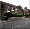
Stone houses, Broughton Road, Moss near Wrexham
Detached houses on the east side of the B5101 Broughton Road.
Image: © Jaggery Taken: 24 Sep 2016
0.25 miles
7
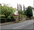
Kent Road bus stop and shelter, Moss
This stop alongside the B5101 Kent Road is for buses to Wrexham.
Image: © Jaggery Taken: 24 Sep 2016
0.25 miles
8
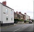
Broughton Road houses, Moss near Wrexham
The B5101 Kent Road is behind the camera. The B5101 Broughton Road is ahead.
Image: © Jaggery Taken: 24 Sep 2016
0.25 miles