
IMAGES TAKEN NEAR TO
Furnace Close, WREXHAM, LL11 5EZ
Introduction
This page details the photographs taken nearby to Furnace Close, LL11 5EZ by members of the Geograph project.
The Geograph project started in 2005 with the aim of publishing, organising and preserving representative images for every square kilometre of Great Britain, Ireland and the Isle of Man.

There are currently over 7.5m images from over14,400 individuals and you can help contribute to the project by visiting https://www.geograph.org.uk
Image Map
Images are licensed for reuse under creativecommons.org/licenses/by-sa/2.0
Notes
- Clicking on the map will re-center to the selected point.
- The higher the marker number, the further away the image location is from the centre of the postcode.
Image Listing (35 Images Found)
Images are licensed for reuse under creativecommons.org/licenses/by-sa/2.0
Image
Details
Distance
1
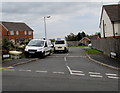
Vron Close, Brymbo
Vron Close (Clos y Fron in Welsh) is a short cul-de-sac on the northeast side of the road named Mount Hill.
Image: © Jaggery
Taken: 24 Sep 2016
0.03 miles
2
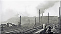
Brymbo: southward at Brymbo Middle Signalbox, 1962
View towards Brymbo (GWR) station and Wrexham to left, towards Vron Colliery to right. Brymbo Steelworks dominates the background. This a typical scene of heavy industry 50+ years ago. See also Image], Image] and Image
Image: © Ben Brooksbank
Taken: 19 Apr 1962
0.06 miles
3
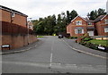
Mount Isa Drive, Brymbo
On the north side of the road named Mount Hill.
Image: © Jaggery
Taken: 24 Sep 2016
0.07 miles
4
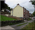
Bryn Melyn, Brymbo
Row of three houses on the north side of Gwalia Road.
Image: © Jaggery
Taken: 24 Sep 2016
0.08 miles
5
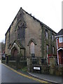
Engedi, Brymbo
Built in 1820, this was a Welsh Presbyterian chapel. It was enlarged in 1840, rebuilt in 1861 and again in 1895.
Image: © Eirian Evans
Taken: 27 Nov 2007
0.08 miles
6
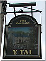
Y Tai pub name sign, Brymbo
Hanging from a chimney bracket here. http://www.geograph.org.uk/photo/5232669
Image: © Jaggery
Taken: 24 Sep 2016
0.10 miles
7
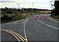
Temporary road closure south of Gwalia Road, Brymbo
A temporary ROAD CLOSED/FFORDD AR GAU sign faces Gwalia Road on September 24th 2016.
Image: © Jaggery
Taken: 24 Sep 2016
0.10 miles
8
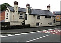
Y Tai pub, Brymbo
Y Tai (Welsh for The Houses) pub viewed across Railway Road.
The What Pub website states that this pub was formerly the Black Lion.
Image: © Jaggery
Taken: 24 Sep 2016
0.10 miles
9
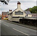
South side of Y Tai pub, Brymbo
Viewed across Railway Road. http://www.geograph.org.uk/photo/5232669 to another view of Y Tai.
Image: © Jaggery
Taken: 24 Sep 2016
0.10 miles
10
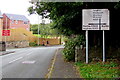
Directions sign facing Railway Road, Brymbo
Located opposite Y Tai pub. http://www.geograph.org.uk/photo/5232669
Image: © Jaggery
Taken: 24 Sep 2016
0.11 miles