
IMAGES TAKEN NEAR TO
Chestnut Road, WREXHAM, LL11 4BX
Introduction
This page details the photographs taken nearby to Chestnut Road, LL11 4BX by members of the Geograph project.
The Geograph project started in 2005 with the aim of publishing, organising and preserving representative images for every square kilometre of Great Britain, Ireland and the Isle of Man.

There are currently over 7.5m images from over14,400 individuals and you can help contribute to the project by visiting https://www.geograph.org.uk
Image Map
Images are licensed for reuse under creativecommons.org/licenses/by-sa/2.0
Notes
- Clicking on the map will re-center to the selected point.
- The higher the marker number, the further away the image location is from the centre of the postcode.
Image Listing (14 Images Found)
Images are licensed for reuse under creativecommons.org/licenses/by-sa/2.0
Image
Details
Distance
1
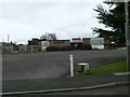
The Queens Head, Bradley
The Queens Head is the only Public House in Bradley and has changed hands a number of times. It closed the end of 2009.
Image: © Eirian Evans
Taken: 17 Feb 2012
0.08 miles
3
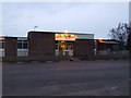
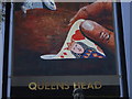
The Queen's Head Inn, Bradley
Just off the main Llay to Wrexham Road, The Queen's Head Inn is situated on Glan Llyn Road, in the centre of Bradley village
Image: © Seren Doyle
Taken: 7 Feb 2009
0.09 miles
4
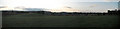
Bradley village on a summer's evening
A panorama of Bradley village from the fields south of the village.
Image: © AntJB
Taken: 23 Jun 2011
0.16 miles
5
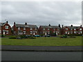
Heol-y-Parc, Bradley
Semi-detached houses in a crescent facing an open green.
Image: © Eirian Evans
Taken: 17 Feb 2012
0.17 miles
6
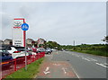
Cycle track beside New Llay Road, Bradley
Looking north east.
Image: © JThomas
Taken: 25 May 2019
0.18 miles
7
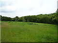
Grazing and woodland near the River Alyn, Bradley
Off the B5425.
Image: © JThomas
Taken: 25 May 2019
0.20 miles
8
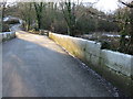
Bradley Mill Bridge and a bench mark
Looking across Bradley Mill Bridge on a frosty winter's morning. On the right of the photo there is an Ordnance Survey bench mark cut into the parapet of the bridge Image, and there are also a number of mason's marks cut into the stonework - Image The bridge crosses the River Alyn, and just beyond, on the right, is the entrance to Alyn Waters Country Park.
Image: © John S Turner
Taken: 29 Dec 2014
0.22 miles
9
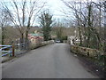
Old stone bridge over the Afon Alun / River Alyn near Bradley Mill Farm
An old bridge on a back lane.
Image: © Jeremy Bolwell
Taken: 9 Mar 2012
0.22 miles
10
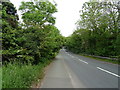
New Llay Road, Bradley
Looking north east on the B5425.
Image: © JThomas
Taken: 25 May 2019
0.22 miles