
IMAGES TAKEN NEAR TO
Chester Road, WREXHAM, LL11 2SJ
Introduction
This page details the photographs taken nearby to Chester Road, LL11 2SJ by members of the Geograph project.
The Geograph project started in 2005 with the aim of publishing, organising and preserving representative images for every square kilometre of Great Britain, Ireland and the Isle of Man.

There are currently over 7.5m images from over14,400 individuals and you can help contribute to the project by visiting https://www.geograph.org.uk
Image Map
Images are licensed for reuse under creativecommons.org/licenses/by-sa/2.0
Notes
- Clicking on the map will re-center to the selected point.
- The higher the marker number, the further away the image location is from the centre of the postcode.
Image Listing (54 Images Found)
Images are licensed for reuse under creativecommons.org/licenses/by-sa/2.0
Image
Details
Distance
1

Bench mark in Chester Road, Wrexham
This bench mark seems much smaller than usual, but it is recorded on the Ordnance Survey database. See also Image
Image: © John S Turner
Taken: 5 Jan 2015
0.02 miles
2
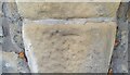
Ordnance Survey Cut Mark
This very worn OS cut mark can be found on the west side of Chester Road. It marks a point 85.106m above mean sea level.
Image: © Adrian Dust
Taken: 22 Oct 2021
0.02 miles
3

Stone wall and a bench mark alongside Chester Road
This stone wall is alongside Chester Road, Wrexham, and there is a bench mark on the stone on the right - Image
Image: © John S Turner
Taken: 5 Jan 2015
0.03 miles
4
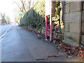
Grove Road and a bench mark
Looking south west along Grove Road past the bus stop. There is an Ordnance Survey bench mark on the stone on the right Image
Image: © John S Turner
Taken: 5 Jan 2015
0.04 miles
5
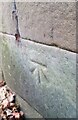
Ordnance Survey Cut Mark
This OS cut mark can be found on the wall of No13 Grove Road. It marks a point 85.167m above mean sea level.
Image: © Adrian Dust
Taken: 22 Oct 2021
0.05 miles
6
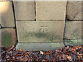
Bench mark in Grove Road, Wrexham
This bench mark is on a stone pillar at the boundary of #13 Grove Road. It is close to a bus stop. See also Image
Image: © John S Turner
Taken: 5 Jan 2015
0.05 miles
7
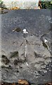
Ordnance Survey Rivet
This OS rivet can be found on the wallof No7 Grove Road. It marks a point 85.335m above mean sea level.
Image: © Adrian Dust
Taken: 22 Oct 2021
0.06 miles
8

The Former Grove Park Girls Grammar School
This fine example of a well-built brick building sadly a casualty of changing attitudes to Grammar School status, and abandoned by an uncaring Council for many years, to dropouts and drug addicts.
Image: © Geoff Evans
Taken: 12 Mar 2013
0.06 miles
9

The Well Built Ex-Grove Park Girls Grammar school
Built as a Girls Grammar school but metamorphosed into a "Comprehensive" and then abandoned because "big is beautiful". Within 50 yards of the Yale Sixth Form college, yet this ready made building could not be utilized as additional teaching space.
Image: © Geoff Evans
Taken: 12 Mar 2013
0.07 miles
10
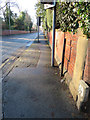
Grove Road from Chester Road, Wrexham
Looking south west along Grove Road from its junction with Chester Road. There is a bench mark on the stone post next to the water stop valve post: Image
Image: © John S Turner
Taken: 5 Jan 2015
0.07 miles