1
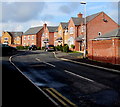
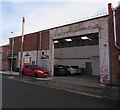
Plas y Ffynnon houses, Wrexham
Houses built in the second decade of the 21st century viewed from the corner of Maesgwyn Road.
Image: © Jaggery
Taken: 12 Feb 2018
0.01 miles
2
Plas y Ffynnon, Wrexham
Houses built in the second decade of the 21st century viewed across Maesgwyn Road.
Image: © Jaggery
Taken: 12 Feb 2018
0.02 miles
3
Public footpath from Maesgwyn Road, Wrexham
Towards Primrose Way and Lilac Way.
Image: © Jaggery
Taken: 12 Feb 2018
0.03 miles
4
Public footpath sign, Maesgwyn Way, Wrexham
The yellow arrow on the sign points towards this https://www.geograph.org.uk/photo/5793998 path towards Primrose Way and Lilac Way.
Image: © Jaggery
Taken: 12 Feb 2018
0.05 miles
5
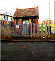
Maesgwyn Waste Water Pumping Station, Wrexham
The Welsh Water site is alongside Maesgwyn Road near this entrance https://www.geograph.org.uk/photo/5694123 to Wrexham Maelor Hospital.
Notices show Please Keep Clear - No Parking - 24 hour access required
and Potentially explosive atmospheres exist on this site.
Image: © Jaggery
Taken: 12 Feb 2018
0.05 miles
6
Benchmark by #30 Maesgwyn Road, Wrexham
Ordnance Survey benchmark on the corner of the boundary wall for #30 Maesgwyn Road. Levelled at 88.231m above Newlyn datum, verified 1959.
Benchmark database: https://www.bench-marks.org.uk/bm197373
Image: © John S Turner
Taken: 15 Jul 2023
0.08 miles
7
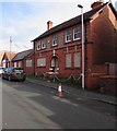
Derelict premises, Maesgwyn Road, Wrexham
Boards protect doors and ground floor windows in February 2018.
Image: © Jaggery
Taken: 12 Feb 2018
0.09 miles
8
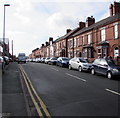
On-street parking, Maesgwyn Road, Wrexham
Parking allowed on the right. Double yellow lines indicate no parking on the left at any time.
Image: © Jaggery
Taken: 12 Feb 2018
0.09 miles
9
Revo, Maesgwyn Road, Wrexham
Revo specialises in performance enhancing hardware & software products for Volkswagen group & Ford vehicles.
Image: © Jaggery
Taken: 12 Feb 2018
0.10 miles
10
The Pavilion flats in Wrexham
Viewed across Maesgwyn Road.
Image: © Jaggery
Taken: 12 Feb 2018
0.11 miles


