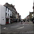
IMAGES TAKEN NEAR TO
Hope Street, WREXHAM, LL11 1AF

Introduction

This page details the photographs taken nearby to Hope Street, LL11 1AF by members of the Geograph project.

The Geograph project started in 2005 with the aim of publishing, organising and preserving representative images for every square kilometre of Great Britain, Ireland and the Isle of Man.

There are currently over 7.5m images from over14,400 individuals and you can help contribute to the project by visiting https://www.geograph.org.uk

Image Map


Images are licensed for reuse under creativecommons.org/licenses/by-sa/2.0
Notes
  • Clicking on the map will re-center to the selected point.
  • The higher the marker number, the further away the image location is from the centre of the postcode.

Image Listing (355 Images Found)

Images are licensed for reuse under creativecommons.org/licenses/by-sa/2.0
  • ...
Image
Details
Distance
1
High Street Wrexham
Looking towards Boots the chemist from near St Giles's church
Image: © Paul Gillett Taken: 16 Nov 2019
0.02 miles
2
View to St Giles Church from Hope Street
Image: © David Robinson Taken: 14 May 2023
0.03 miles
3
Hope Street, Wrexham
The Welsh name for Hope Street, Stryd yr Hôb dates from the origins of the town when it was the road leading out to the village of Hope. *Source: Wrexham.gov.uk
Image: © Jeff Buck Taken: 16 Mar 2016
0.03 miles
4
Chatwins, High Street, Wrexham
Bakery, carvery and coffee shop at 3 High Street.
Image: © Jaggery Taken: 24 Sep 2016
0.03 miles
5
Shops on Wrexham High Street
Image: © Stephen Craven Taken: 26 May 2017
0.03 miles
6
Flush Bracket S1201 on Butchers' Market, Wrexham
This Ordnance Survey Flush Bracket is on the east side of the entrance to the historic Butchers' Market building on the north side of High Street. FB S1202 is nearby on the south side of the church of St Giles - see Image
Image: © John S Turner Taken: 31 Aug 2009
0.03 miles
7
Butchers Market, High Street Wrexham
Built in 1848 according to the signage - a 19th Century supermarket as so well described by Eirian Evans in his 2010 imageImage] which provides excellent detail. There have been a few changes - note the adjoining properties to the left.
Image: © Richard Hoare Taken: 23 Nov 2013
0.03 miles
8
Hope Street, Wrexham
The Welsh name for Hope Street, Stryd yr Hôb dates from the origins of the town when it was the road leading out to the village of Hope. *Source: Wrexham.gov.uk
Image: © Jeff Buck Taken: 16 Mar 2016
0.04 miles
9
British Home Stores in administration, Wrexham
When this BHS closes for good in the coming days, it will complete the parade of empty units here, in what was the heart of Wrexham.
Image: © Matt Harrop Taken: 22 Jul 2016
0.04 miles
10
West along High Street, Wrexham
The corner of Yorke Street is on the left.
Image: © Jaggery Taken: 24 Sep 2016
0.04 miles
  • ...