IMAGES TAKEN NEAR TO
Archers Lane, LEICESTER, LE9 7RL
Introduction
This page details the photographs taken nearby to Archers Lane, LE9 7RL by members of the Geograph project.
The Geograph project started in 2005 with the aim of publishing, organising and preserving representative images for every square kilometre of Great Britain, Ireland and the Isle of Man.

There are currently over 7.5m images from over14,400 individuals and you can help contribute to the project by visiting https://www.geograph.org.uk
Image Map
Images are licensed for reuse under creativecommons.org/licenses/by-sa/2.0
Notes
- Clicking on the map will re-center to the selected point.
- The higher the marker number, the further away the image location is from the centre of the postcode.
Image Listing (36 Images Found)
Images are licensed for reuse under creativecommons.org/licenses/by-sa/2.0
Image
Details
Distance
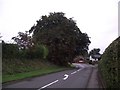
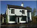
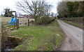
1
Peckleton-Archers Lane
Near the junction with Main Street.
Image: © Ian Rob
Taken: 5 Apr 2019
0.01 miles
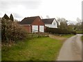
4
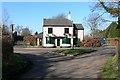
The Peckleton Restaurant
On the Main Street of Peckleton, opposite the junction with Manor Lane.
Image: © Mat Fascione
Taken: 17 Feb 2008
0.03 miles
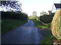
5
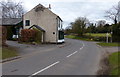
Little India on the Main Street of Peckleton
Image: © Mat Fascione
Taken: 3 Mar 2013
0.03 miles
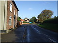
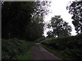
8
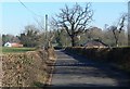
Travelling east along Kirkby Lane
On the western edge of the Leicestershire village of Peckleton.
Image: © Mat Fascione
Taken: 17 Feb 2008
0.07 miles