IMAGES TAKEN NEAR TO
Faraday Close, LEICESTER, LE9 6WF
Introduction
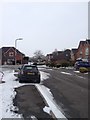
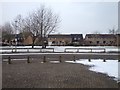
This page details the photographs taken nearby to Faraday Close, LE9 6WF by members of the Geograph project.
The Geograph project started in 2005 with the aim of publishing, organising and preserving representative images for every square kilometre of Great Britain, Ireland and the Isle of Man.

There are currently over 7.5m images from over14,400 individuals and you can help contribute to the project by visiting https://www.geograph.org.uk
Image Map
Images are licensed for reuse under creativecommons.org/licenses/by-sa/2.0
Notes
- Clicking on the map will re-center to the selected point.
- The higher the marker number, the further away the image location is from the centre of the postcode.
Image Listing (3 Images Found)
Images are licensed for reuse under creativecommons.org/licenses/by-sa/2.0
Image
Details
Distance
2
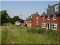
Broughton Astley
Broughton Astley has seen a large amount of new development in recent years. This is the south eastern edge of the village where housing has almost encroached as far as this footpath, which leads across the bridge over a disused railway, just visible in the trees.
Image: © Stephen McKay
Taken: 2 Jul 2006
0.20 miles