IMAGES TAKEN NEAR TO
Grove Road, LEICESTER, LE8 6LN
Introduction
This page details the photographs taken nearby to Grove Road, LE8 6LN by members of the Geograph project.
The Geograph project started in 2005 with the aim of publishing, organising and preserving representative images for every square kilometre of Great Britain, Ireland and the Isle of Man.

There are currently over 7.5m images from over14,400 individuals and you can help contribute to the project by visiting https://www.geograph.org.uk
Image Map
Images are licensed for reuse under creativecommons.org/licenses/by-sa/2.0
Notes
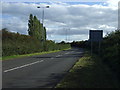
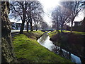
- Clicking on the map will re-center to the selected point.
- The higher the marker number, the further away the image location is from the centre of the postcode.
Image Listing (28 Images Found)
Images are licensed for reuse under creativecommons.org/licenses/by-sa/2.0
Image
Details
Distance
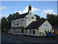
4
The Lime Tree in Whetstone
Public House on Cambridge Road, formally called the Kaffir Inn.
Image
Image: © Mat Fascione
Taken: 16 Nov 2021
0.12 miles
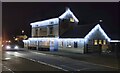
5

Whetstone-The Kaffir Inn
Public House on Cambridge Road.
Image: © Ian Rob
Taken: 28 May 2011
0.12 miles
8
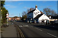
The Kaffir Inn on Cambridge Road, Whetstone
Image, later renamed to the Lime Tree.
Image: © Mat Fascione
Taken: 22 Dec 2013
0.14 miles
9
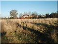
Westfield Park Blaby
Less Park, more wildlife refuge and dog walking area.
Image: © Michael Trolove
Taken: 7 Dec 2008
0.14 miles