IMAGES TAKEN NEAR TO
Winchester Road, LEICESTER, LE8 5PR
Introduction
This page details the photographs taken nearby to Winchester Road, LE8 5PR by members of the Geograph project.
The Geograph project started in 2005 with the aim of publishing, organising and preserving representative images for every square kilometre of Great Britain, Ireland and the Isle of Man.

There are currently over 7.5m images from over14,400 individuals and you can help contribute to the project by visiting https://www.geograph.org.uk
Image Map
Images are licensed for reuse under creativecommons.org/licenses/by-sa/2.0
Notes
- Clicking on the map will re-center to the selected point.
- The higher the marker number, the further away the image location is from the centre of the postcode.
Image Listing (18 Images Found)
Images are licensed for reuse under creativecommons.org/licenses/by-sa/2.0
Image
Details
Distance
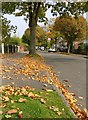
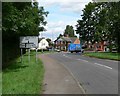
1
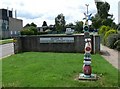
Countesthorpe Community College
The sign is one of the Sustrans National Cycle Network Signs, in this case for Route 6, this is similar to ones at Image and Image and Image
Image: © Mat Fascione
Taken: 28 Jul 2007
0.04 miles
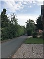
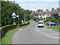
2
Countesthorpe Community College
Along Winchester Road in Countesthorpe.
Image: © Mat Fascione
Taken: 8 Sep 2017
0.07 miles
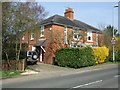
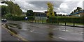
3
Cosby Road, Countesthorpe
Looking towards its junction with Winchester Road.
Image: © Mat Fascione
Taken: 28 Jul 2007
0.07 miles
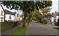
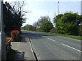
4
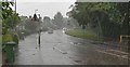
Torrential rain on Winchester Road in Countesthorpe
Image: © Mat Fascione
Taken: 8 Sep 2017
0.07 miles