1
Former estate cottages, Main Street, Scraptoft
Extended at both sides in the early 21st century. The initials http://www.geograph.org.uk/photo/5735118 on the cottage possibly refer to the Hartopp family who were associated with Scraptoft Hall.
Credit to the architect responsible; unlike most modern pastiche of traditional design, where stretcher bond brickwork is a give-away of the newness, here care has been taken to reproduce the proper Flemish bond pattern, even though the 'headers' are probably only a half brick deep.
There is a bench mark http://www.geograph.org.uk/photo/5735116 just to the left of the passage under the building.
Image: © Alan Murray-Rust
Taken: 5 Apr 2018
0.10 miles
2
Datestone and crest, Maomyo, Main Street, Scraptoft
Probably relating to the Hartopp family of Scraptoft Hall. See http://www.geograph.org.uk/photo/5735122 for location.
Image: © Alan Murray-Rust
Taken: 5 Apr 2018
0.10 miles
3
Bench mark, Maomyo, Main Street, Scraptoft
See http://www.geograph.org.uk/photo/5735122 for location.
Image: © Alan Murray-Rust
Taken: 5 Apr 2018
0.10 miles
4
Main Street, Scraptoft
This has lost much of its village character with the advent of major housing development round and about. The local Co-operative store still houses a local Post Office.
Image: © Alan Murray-Rust
Taken: 5 Apr 2018
0.13 miles
5
Beeby Road, Scraptoft
Image: © Mat Fascione
Taken: 17 Jun 2007
0.13 miles
6
Pool near Scraptoft Hall
Image: © Mat Fascione
Taken: 25 Jul 2018
0.13 miles
7
Pear Tree Stores and Rose Cottage, Scraptoft
The stores have probably been trading here for some time, although unlikely to go back quite as far as the house, which is dated 1703 http://www.geograph.org.uk/photo/5735094 . Rose Cottage, with the thatched roof, dates from around the same time, but has been substantially modernised. Both buildings are Listed Grade II, Rose Cottage for group value only.
Image: © Alan Murray-Rust
Taken: 5 Apr 2018
0.14 miles
8
Pear Tree Stores ? datestone
See http://www.geograph.org.uk/photo/5735093 for location.
Image: © Alan Murray-Rust
Taken: 5 Apr 2018
0.14 miles
9
Hamilton Lane north of Scraptoft
Looking north from near the fringe of Scraptoft village, towards Nether Hall. Confusingly, the Scraptoft village sign (right) is double sided.
Image: © Richard Vince
Taken: 13 Oct 2012
0.14 miles
10
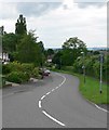
Church Hill
Image: © Andrew Tatlow
Taken: 18 Apr 2013
0.15 miles


