IMAGES TAKEN NEAR TO
Main Street, LEICESTER, LE7 9PN
Introduction
This page details the photographs taken nearby to Main Street, LE7 9PN by members of the Geograph project.
The Geograph project started in 2005 with the aim of publishing, organising and preserving representative images for every square kilometre of Great Britain, Ireland and the Isle of Man.

There are currently over 7.5m images from over14,400 individuals and you can help contribute to the project by visiting https://www.geograph.org.uk
Image Map
Images are licensed for reuse under creativecommons.org/licenses/by-sa/2.0
Notes
- Clicking on the map will re-center to the selected point.
- The higher the marker number, the further away the image location is from the centre of the postcode.
Image Listing (36 Images Found)
Images are licensed for reuse under creativecommons.org/licenses/by-sa/2.0
Image
Details
Distance
1
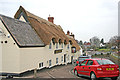
The Rose and Crown, Thurnby near Leicester
On Main Street this pub sports a fine newly thatched roof.
Image: © Kate Jewell
Taken: 5 Jan 2006
0.04 miles
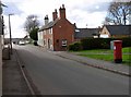
2

St Luke's Church of England Primary School, Thurnby
Grade II Listed, dated 1865 https://historicengland.org.uk/listing/the-list/list-entry/1360635
Image: © Tim Heaton
Taken: 21 Mar 2020
0.07 miles
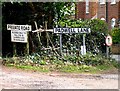
4
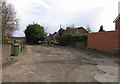
Padwell Lane
The track to the left appears to be named Private Road!
Image: © Andrew Tatlow
Taken: 18 Apr 2013
0.09 miles
9
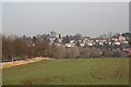
Thurnby
Long view to Thurnby from Stoughton Road layby
Image: © Richard Croft
Taken: 19 Jan 2011
0.10 miles
10
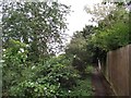
Footpath from the Uppingham Road to Main Street
Image: © Tim Glover
Taken: 30 Jul 2016
0.11 miles