IMAGES TAKEN NEAR TO
Long Close, LEICESTER, LE7 7QG
Introduction
This page details the photographs taken nearby to Long Close, LE7 7QG by members of the Geograph project.
The Geograph project started in 2005 with the aim of publishing, organising and preserving representative images for every square kilometre of Great Britain, Ireland and the Isle of Man.

There are currently over 7.5m images from over14,400 individuals and you can help contribute to the project by visiting https://www.geograph.org.uk
Image Map
Images are licensed for reuse under creativecommons.org/licenses/by-sa/2.0
Notes
- Clicking on the map will re-center to the selected point.
- The higher the marker number, the further away the image location is from the centre of the postcode.
Image Listing (9 Images Found)
Images are licensed for reuse under creativecommons.org/licenses/by-sa/2.0
Image
Details
Distance
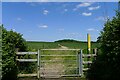
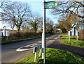
2
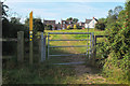
Gate and path, Anstey
A path junction on the route to Bradgate Country Park.
Image: © Jim Barton
Taken: 13 Sep 2019
0.13 miles
3
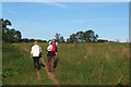
Field path, Anstey
A path from Anstey to Bradgate Country Park.
Image: © Jim Barton
Taken: 13 Sep 2019
0.18 miles
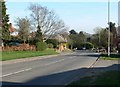
4
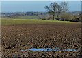
Farmland north of the village of Anstey
Image: © Mat Fascione
Taken: 29 Dec 2013
0.20 miles
5
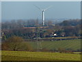
Countryside north of Anstey
View across the village of Cropston towards the 132 metres (434 feet) Wanlip wind turbine.
Image: © Mat Fascione
Taken: 29 Dec 2013
0.21 miles
6
Bridleway north from Anstey
Leads to Cropston
Image: © Tim Heaton
Taken: 3 Jun 2023
0.22 miles
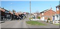
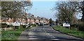
8
Footpath along Bradgate Road in Anstey
Image: © Mat Fascione
Taken: 29 Dec 2013
0.24 miles