IMAGES TAKEN NEAR TO
Copt Oak Road, MARKFIELD, LE67 9PJ
Introduction
This page details the photographs taken nearby to Copt Oak Road, LE67 9PJ by members of the Geograph project.
The Geograph project started in 2005 with the aim of publishing, organising and preserving representative images for every square kilometre of Great Britain, Ireland and the Isle of Man.

There are currently over 7.5m images from over14,400 individuals and you can help contribute to the project by visiting https://www.geograph.org.uk
Image Map
Images are licensed for reuse under creativecommons.org/licenses/by-sa/2.0
Notes
- Clicking on the map will re-center to the selected point.
- The higher the marker number, the further away the image location is from the centre of the postcode.
Image Listing (27 Images Found)
Images are licensed for reuse under creativecommons.org/licenses/by-sa/2.0
Image
Details
Distance
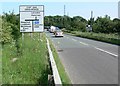
2
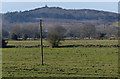
Bardon Hill viewed from Whitwick Road
Bardon Hill is the highest point in Leicestershire, its summit is 278 m (912 ft) above sea level.
Image: © Mat Fascione
Taken: 8 Feb 2015
0.10 miles
6
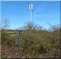
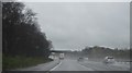
Communications mast next to the M1 motorway
Image: © Mat Fascione
Taken: 8 Feb 2015
0.16 miles
10
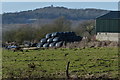
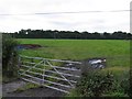
Pettifors Farm near Copt Oak
In the distance is Bardon Hill, the highest point in Leicestershire, its summit is 278 m (912 ft) above sea level.
Image: © Mat Fascione
Taken: 8 Feb 2015
0.19 miles