IMAGES TAKEN NEAR TO
Ulverscroft, MARKFIELD, LE67 9PB
Introduction
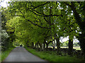
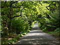
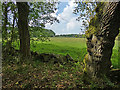
This page details the photographs taken nearby to LE67 9PB by members of the Geograph project.
The Geograph project started in 2005 with the aim of publishing, organising and preserving representative images for every square kilometre of Great Britain, Ireland and the Isle of Man.

There are currently over 7.5m images from over14,400 individuals and you can help contribute to the project by visiting https://www.geograph.org.uk
Image Map
Images are licensed for reuse under creativecommons.org/licenses/by-sa/2.0
Notes
- Clicking on the map will re-center to the selected point.
- The higher the marker number, the further away the image location is from the centre of the postcode.
Image Listing (11 Images Found)
Images are licensed for reuse under creativecommons.org/licenses/by-sa/2.0
Image
Details
Distance

6
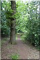
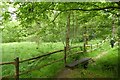
Footpath in Stoneywell Wood
Stoneywell is a house and garden of the National Trust which opened to the public in 2015 (after a few preview openings in 2014). The wood is on one boundary of the estate
Image: © David Smith
Taken: 12 Jun 2015
0.20 miles